

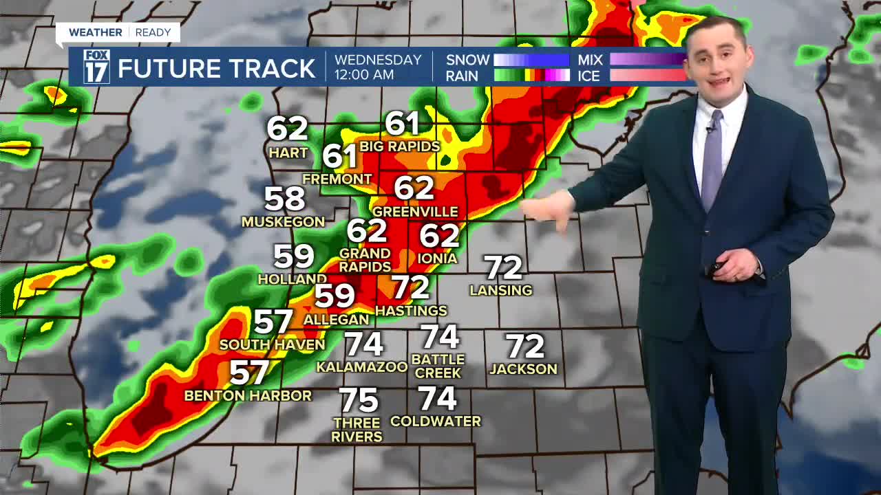


The forecast from FOX 17 Weather Ready Meteorologist Colton Cichoracki: Sunday was the warmest day of 2026 so far with temperatures reaching the upper 70s and lower 80s around West Michigan. While warm weather will continue into the new week, things will turn much more active as well. A Flood Watch has been issued for Oceana, Newaygo and Mecosta counties until Wednesday morning. Our first chance for widespread rain will come in overnight around midnight. This will bring a steady rain and a few embedded thunderstorms but severe weather and flooding is not likely. Temperatures fall to around 60 overnight. Most of Monday is also trending dry. We start mostly cloudy but should see some sunshine towards the afternoon. Shower and storm chances return by the evening, and some storms could be strong with West Michigan under a Marginal risk for severe weather. Gusty winds and small hail look to be the main hazards with these storms. However, the better chance for severe storms will come on Tuesday, being under a Slight risk for severe storms between Tuesday evening and Wednesday morning. Rain chances will stay in the forecast daily this week, with temperatures held in the 70s. Tuesday is a FOX 17 Weather Ready Alert Day due to the risk for severe storms. Multiple rounds of heavy rain will bring river levels back up and some flooding is expected throughout the week. Stay tuned for updates.
TONIGHT: Steady, widespread rain with a few embedded thunderstorms. Lows in the upper 50s to lower 60s. SW wind 15-25 mph.
MONDAY: Mostly cloudy becoming partly sunny. Highs in the low/mid 70s. Chance showers/storms late in the evening, some strong-severe possible. SW wind 5 to 15 mph.
TUESDAY: FOX 17 Weather Ready Alert: Mostly cloudy becoming partly sunny. Rain and thunderstorms in the evening, overnight, severe storms possible. Highs in the mid/upper 70s.
WEDNESDAY: Mostly cloudy with showers/storms likely. Highs in the low 70s.
THURSDAY: Mostly cloudy with rain likely. Highs around 70.
FRIDAY: Mostly to partly cloudy. Very warm Highs in the mid to upper 70s.
SATURDAY: Thunderstorms likely. Highs in the upper 60s.
SUNDAY: Much colder and cloudy. Highs in the upper 40s.
Follow FOX 17: Facebook - X (formerly Twitter) - Instagram - YouTube
