
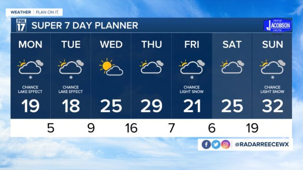


WEST MICHIGAN — The forecast from FOX 17 Meteorologist Reece Cole: Grand Rapids has eclipsed its seasonal snowfall average of 77.6", seeing 78.5" through January 28. Lake effect snow will turn light for the start of the work week as much cooler air settles in to ring in February. Snow accumulations will be light and isolated both days, but Monday will be more scattered than Tuesday. Overnight lows will be in the single digits multiple nights this week, and afternoon highs struggling to hit 30 degrees through Friday. The coldest day is anticipated to be Tuesday, with highs slowly returning to the lower and mid 20s by the end of week. Remember to bundle up! Stay tuned for updates and download the free FOX 17 Weather App for the latest forecast video.
TONIGHT: Mostly cloudy and cold. Lows in the middle teens. Winds north-northwest, light.
MONDAY: Mostly cloudy with lingering flurries. Highs in the lower 20s. Winds west-northwest at 5 to 15 mph.
TUESDAY: Mostly cloudy, few lake effect flurries possible. Highs in the upper teens to near 20 degrees.
WEDNESDAY: Partly cloudy to mostly cloudy. Highs in the lower and mid 20s.
THURSDAY: Mostly cloudy skies. Highs in the lower and mid 20s.
FRIDAY: Cloudy with a chance of light snow. Highs in the lower 20s.
For the latest details on the weather in West Michigan, head to the FOX 17 Weather page.
