
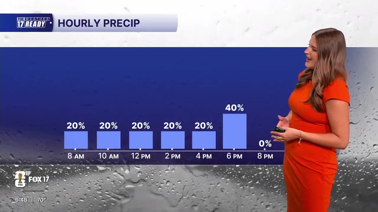


WEST MICHIGAN — The forecast from FOX 17 Weather Ready Meteorologist Gracyn Freund: Mostly cloudy skies today will hold temperatures back to the lower 80s but it will still be very humid. Scattered showers will be possible through most of the day, with a few thunderstorms and some pockets of heavy rain more likely south of I-94. It won't be a washout, but make sure to keep an eye on the radar if you have any outdoor plans or if you'll be doing any traveling. There may be a few left over showers and storms around tonight into very early Monday, then a dry and quiet stretch of weather will settle in through the first half the work week. Expect plenty of sunshine Monday through Wednesday, with storm chances returning Wednesday night into Thursday. Temperatures will likely be held to the 80s this week, with lower humidity as well. Definitely a big sigh of relief after the extreme heat and humidity last week!
TODAY: Mostly cloudy with scattered showers and thunderstorms. Highs in the upper 70s/low 80s, humid. Wind ENE at 10-15 mph.
TONIGHT: Slight chance showers and storms, otherwise mostly cloudy turning partly cloudy. Lows around 60. Wind NE at 5-10 mph.
MONDAY: Mostly sunny. Highs in the low/mid 80s, a touch humid. Wind ENE at 10-15 mph.
TUESDAY: Mostly sunny with highs in the mid 80s.
WEDNESDAY: Mostly sunny with highs in the upper 80s.
THURSDAY: Partly cloudy with chance showers and storms, highs in the mid 80s.
FRIDAY: Partly cloudy with chance showers, highs in the lower 80s.
SATURDAY: Partly cloudy with highs in the low/mid 80s.
Want alerts when inconvenient or severe weather is headed your way? Download the FOX 17 Weather app and set up notifications for where you live.
For the latest details on the weather in West Michigan, head to the FOX 17 Weather page.
Follow FOX 17: Facebook - X (formerly Twitter) - Instagram - YouTube
