
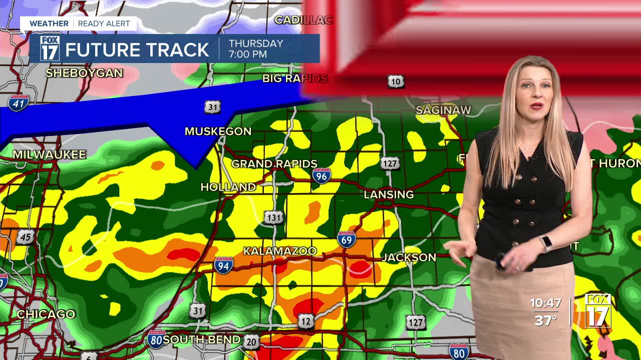


The forecast from FOX 17 Weather Ready Meteorologist Kara James: The Spring roller coaster ride continues, with even warmer temperatures the next few days! Temperatures won't be quite as cold overnight, with lows around freezing. A few isolated showers are possible Wednesday with highs climbing into the low 60s for most, but there are better chances Thursday as a cold front arrives. Showers will move in during the early to mid afternoon, with thunderstorms also possible in the late afternoon and evening as temperatures soar into the upper 60s or warmer. The better chance of a strong or briefly severe thunderstorm will be from Grand Rapids southward where there is a MARGINAL RISK (level 1/5) with gusty winds and 1" hail as the primary threats. Our weekend looks dry and quiet, but cooler with temperatures back in to the 40s for highs and 20s in the mornings. Normal highs for this time of year are in the upper 40s. Longer range forecasts indicate we may see temperatures well above normal as we head into the first week of April, along with a more active pattern.
TONIGHT: Partly to mostly cloudy. Lows in the lower 30s. Winds southeast at 5 to 10 mph.
WEDNESDAY: Mostly cloudy and mild. Slight chance of a P.M. shower, mainly from Grand Rapids northward. Highs in the low 60s. Winds southeast/south at 5 to 15 mph.
THURSDAY: Mostly cloudy and warm with P.M. and nighttime showers and thunderstorms. Some storms may be strong to marginally severe with wind or hail, mainly from Grand Rapids south. Highs in the upper 60s to low 70s.
FRIDAY: Becoming partly cloudy and cooler. Highs in the lower 40s.
SATURDAY: Mostly sunny. Highs in the middle 40s.
SUNDAY: Partly cloudy. Highs in the lower 50s.
MONDAY: Partly cloudy. Highs in the upper 50s.
TUESDAY: Chance showers. Highs near 60.
For the latest details on the weather in West Michigan, head to the FOX 17 Weather page.
Follow FOX 17: Facebook - X (formerly Twitter) - Instagram - YouTube
