


The forecast from FOX 17 Weather Ready Meteorologist Colton Cichoracki: Some light snow is on the way to West Michigan to begin the day Wednesday. This should be light with totals less than an inch but it could cause some slick roads for the morning commute. After that moves away, the rest of Wednesday is dry with highs in the 30s. Starting Thursday and into next week, a return to warmer and quieter weather happens just in time for the official start to Spring on Friday! It's what we call the vernal equinox and officially arrives at 10:46 A.M.. It's the exact time the sun is directly overhead of the equator. It also marks the start of Fall for the southern hemisphere.
TONIGHT: Mostly cloudy. Chance of light snow or snow showers late. Lows in the teens. Winds southwest/south at 5 to 10 mph.
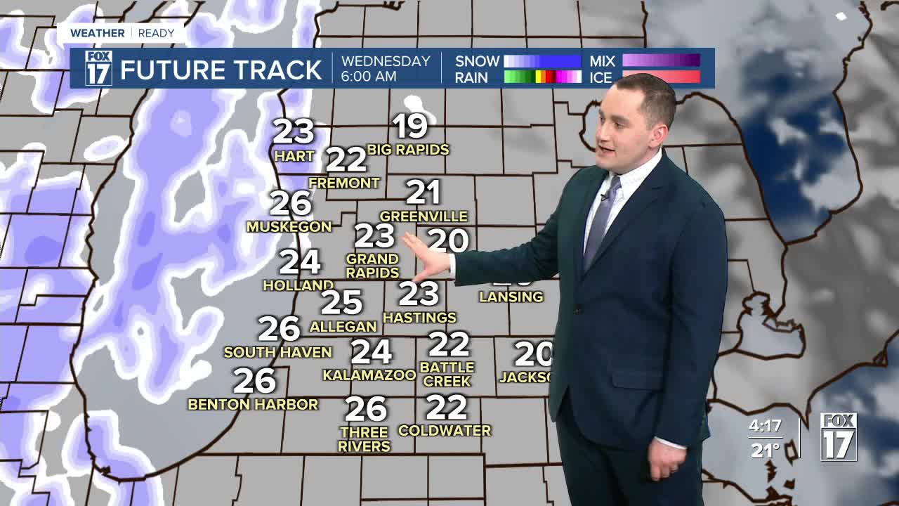
WEDNESDAY: Mostly cloudy light snow or snow showers, mainly early. Less than an inch, except in Muskegon and Oceana Counties. A moisture feed off Lake Michigan may generate 2" to 3" in those areas. Warmer too! Highs in the mid/upper 30s. Winds southeast/southwest at 10 to 15 mph.
THURSDAY: Mostly cloudy. Chance of light rain showers early. Some wet flakes may mix in. Warmer with highs in the middle 40s.
FRIDAY: Partly sunny to mostly cloudy. Highs in the lower 50s.
SATURDAY: Partly cloudy to partly sunny. Highs in the mid to upper 50s.
SUNDAY: Mostly cloudy. Chance or rain/snow showers. Highs in the upper 40s to lower 50s.
MONDAY: Partly cloudy. Highs in the lower 40s.
TUESDAY: Mostly cloudy. Highs in the middle 40s.
For the latest details on the weather in West Michigan, head to the FOX 17 Weather page.
Follow FOX 17: Facebook - X (formerly Twitter) - Instagram - YouTube
