


The forecast from FOX 17 Weather Ready Meteorologist Reece Cole: Our 4th of July weekend looks mostly sunny and hot to start, with showers and storms to end. There is also a CLEAN AIR ACTION DAY and AIR QUALITY ADVISORY due to higher ozone levels, and watch for pockets of firework smoke to impact breathing levels at night. Try not to operate any gas powered equipment...it helps with air quality here at the surface. Our fireworks forecast looks dry and mostly clear, but warm this evening! Thunderstorm chances build inot Sunday morning, but expected just scattered pockets of rain, some may even stay dry! Watch for feels like temperatures in the mid 90s on Saturday! Stay tuned to the FOX 17 Weather Ready Team for your latest forecast updates.
TONIGHT: Mostly clear, warm, and quiet. Lows around 70. Winds southwest at 5 to 10 mph.
SATURDAY: Mostly sunny, breezy, hot, and muggy. Highs in the low/mid 90s. Heat index values in the mid 90s. Winds southwest at 10 to 20 mph. BEACH HAZARD STATEMENTS Ottawa county to the north for 2 to 5 foot waves.s
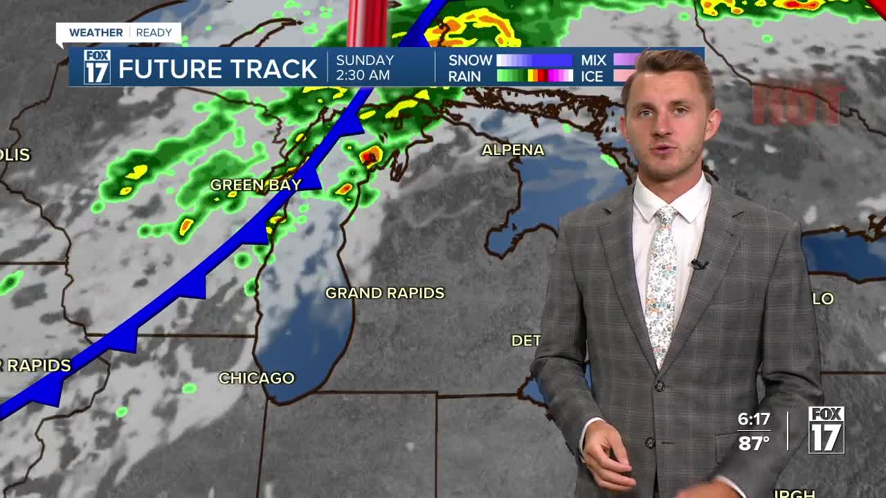
SUNDAY: Partly sunny, warm, and muggy with scattered showers and thunderstorms. Highs in the mid 80s. 3 to 5 foot waves expected.
MONDAY: Morning clouds, otherwise some afternoon sunshine. A bit cooler and less humid. Highs in the low/mid 80s.
TUESDAY: Mostly sunny and pleasant. Highs in the low/mid 80s.
WEDNESDAY: Partly sunny with a chance of showers. Highs in the mid 80s.
For the latest details on the weather in West Michigan, head to the FOX 17 Weather page.
Follow FOX 17: Facebook - X (formerly Twitter) - Instagram - YouTube
