
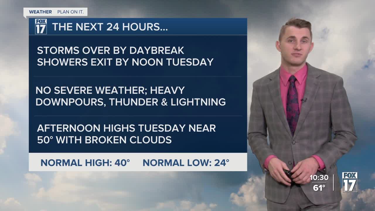


The forecast from FOX 17 Meteorologist Reece Cole: We had record high temperatures in a few spots on Sunday, even more records on Monday! Grand Rapids broke the old record of 66 degrees for March 4, hitting 70 today! Record temps are done for the foreseeable future, as a cold front slides in tonight and Tuesday allowing for showers and a few thunderstorms. Severe thunderstorms are not likely. Rain will linger into Tuesday morning as temperatures fall back into the upper 40s. High temperatures will remain in the 50s for Wednesday and Thursday, before additional rain chances and cooler air returns Friday evening and into the weekend. A few snowflakes are possible Saturday and/or Sunday. Stay up to date with the FOX 17 Weather Team.
TONIGHT: Mostly cloudy and mild with showers and a few thunderstorms. No severe weather is expected. Lows in the upper 40s. Winds southwest/north at 5 to 15 mph.
TUESDAY: Scattered showers, perhaps a rumble of thunder, mainly through the morning. Otherwise, mostly cloudy. Cooler too. Highs in the mid/upper 50s. Winds north-northeast at 5 to 15 mph.
WEDNESDAY: Partly cloudy and pleasant. Highs in the lower 50s.
THURSDAY: Mostly sunny to partly cloudy. Highs in the lower to middle 50s.
FRIDAY: Increasing clouds with showers developing in the afternoon and lasting overnight. Highs in the lower 50s.
For the latest details on the weather in West Michigan, head to the FOX 17 Weather page.
Follow FOX 17: Facebook - X (formerly Twitter) - Instagram - YouTube
