
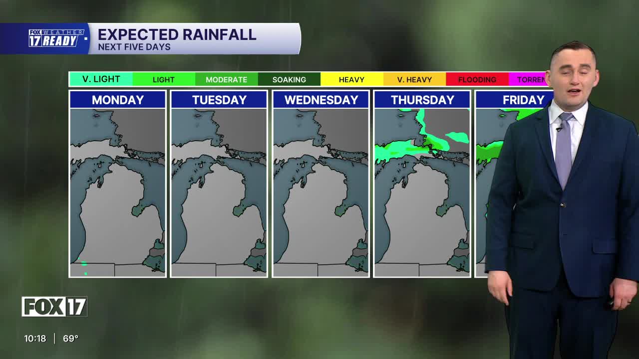


The forecast from FOX 17 Weather Ready Meteorologist Colton Cichoracki: The Omega blocking weather pattern that began last week is holding steady to start this week, and to start the month of June! Dry and pleasant weather will continue through Thursday, with increasingly warm temperatures. Upper 70s and low 80s will be the rule, along with lots of sunshine and a bit of a breeze. With low relative humidity and continued dry, breezy conditions, an increased fire risk is now setting in. Be very careful when burning campfires or brush, as they have the potential to ignite surrounding vegetation quickly. We may start to see red flag watches/warnings issued for the fire threat! As the Omega Block starts to break down towards the end of the week, humidity levels will also begin to increase. This transition will open the door for our next opportunity for rain, with scattered shower and thunderstorm chances returning Friday night into Saturday. Considering how dry May has been overall and how long it's been since we've seen much rain, we can definitely use it!
TONIGHT: Mostly clear and comfortable. Lows in the upper 40s. Wind east-northeast at 5 to 10 mph.
TUESDAY: Sunny, warm, and pleasant. Highs in the upper 70s to near 80. Winds east-northeast at 5 to 15 mph.
WEDNESDAY: Sunny, warm, and pleasant. Highs in the low 80s.
THURSDAY: Mostly sunny to partly cloudy. Highs in the low 80s.
FRIDAY: Partly sunny, warmer, and more humid. Chance of P.M. and nighttime showers/storms. Highs in the low/mid 80s.
SATURDAY: Partly sunny to mostly cloudy and humid with a chance of showers and thunderstorms. Humid. Highs near 80.
SUNDAY: Mostly cloudy and humid with a chance of showers and thunderstorms. Highs in the low 80s.
MONDAY: Partly to mostly cloudy with the chance for a shower. High around 80.
Want alerts when inconvenient or severe weather is headed your way? Download the FOX 17 Weather app and set up notifications for where you live.
For the latest details on the weather in West Michigan, head to the FOX 17 Weather page.
Follow FOX 17: Facebook - X (formerly Twitter) - Instagram - YouTube
