


The forecast from FOX 17 Weather Ready Meteorologist Colton Cichoracki: After some spectacular weather to start the week, we do have a FOX 17 Weather Ready Alert for Monday night into Tuesday due to the risk for strong to severe thunderstorms. This will come in waves with our first chance for storms Monday night and then again on Tuesday. The Storm Prediction Center has highlighted West Michigan in a level one marginal risk for severe storms Monday night and a level two slight risk for Tuesday. Damaging winds, large hail, and heavy rain are the main threats with any storms but a brief tornado is also possible. Tonight into Tuesday morning, shower and storm chances begin to increase. The main window for storms will be from midnight to 6 a.m. On Tuesday, a cold front will bring showers and storms to the area with highs in the upper 60s. There may be a few different rounds...perhaps one in the early morning, then additional storms in the afternoon/evening before the cold front clears the area. Another system will move in for Thursday. This one looks like mostly rain but with some colder air around, we will need to keep an eye on the rain mixing in with some snow showers or freezing rain early Thursday morning. It's possible some locations could see 2" to 3" of rain by the end of this week.
TONIGHT: FOX 17 WEATHER READY ALERT: Becoming mostly cloudy and mild. Chance of showers/storms after midnight. Some may be strong/severe with large hail. Lows in the mid/upper 50s. Winds southwest at 5 to 15 mph.
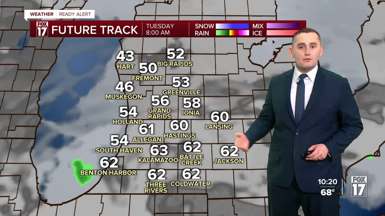
TUESDAY: FOX 17 WEATHER READY ALERT DAY! Mostly cloudy, breezy, and warm with showers/storms likely. We may see some in the morning, then another round or two possible in the afternoon/evening. Some storms could be strong to severe. Hail is the primary threat, but damaging winds also possible. Low tornado threat. Highs in the upper 60s. Winds southwest at 10 to 20 mph.
WEDNESDAY: Mostly cloudy and cooler. Chance of P.M. and nighttime showers. Highs in the upper 40s.
THURSDAY: Cloudy and mild with some snow showers or freezing rain possible early, otherwise changing to all rain. Heavy rain possible. Highs in the mid to upper 50s.
FRIDAY: Showers early, otherwise mostly cloudy. Highs in the upper 50s.
SATURDAY: Cloudy with rain likely. Highs in the lower 60s.
SUNDAY: Mostly cloudy and cooler. A few sprinkles or flurries possible early. Highs in the middle 40s.
MONDAY: Mostly cloudy. Highs in the low 50s.
Follow FOX 17: Facebook - X (formerly Twitter) - Instagram - YouTube
