


The forecast from FOX 17 Weather Ready Meteorologist Reece Cole: Highs have once again surpassed 90 degrees in spots, with feels like temperatures in the middle 90s. Heat relief finally comes tomorrow with a stronger cold front, along with scattered showers and thunderstorms. The air conditioners finally get a break for the second half of the week with much lower humidity, highs slipping into the upper 70s and low 80s, and overnight lows in the comfortable 50s and 60s. We may be able to start seeing the Perseid Meteors in the coming days, but they don't peak until August 12/13. This is an annual event and stems from debris from the tail of the comet Swift Tuttle. Stay tuned to the FOX 17 Weather Ready Team for your latest forecast updates.
TONIGHT: Partly to mostly cloudy, warm, and muggy. Chance of a shower/storm. Lows in the upper 60s. Winds light/variable.
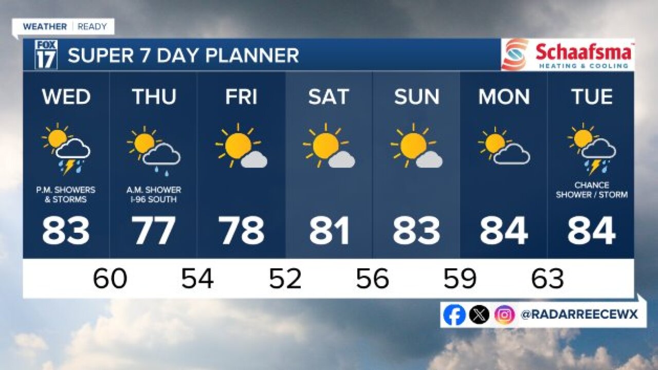
WEDNESDAY: Partly sunny, cooler, gradually less humid. Scattered showers/storms develop in the afternoon and evening. Highs in the lower 80s. Winds northeast at 5 to 15 mph.
THURSDAY: Mostly sunny and pleasant after a few morning showers south of I-96. Highs in the upper 70s.
FRIDAY: Mostly sunny and pleasant. Highs in the upper 70s.
SATURDAY: Mostly sunny. Highs in the low 80s.
SUNDAY: Mostly. Highs in the lower 80s.
MONDAY: Partly cloudy and warmer. Chance of an isolated shower/storm. Highs in the mid 80s.
For the latest details on the weather in West Michigan, head to the FOX 17 Weather page.
Follow FOX 17: Facebook - X (formerly Twitter) - Instagram - YouTube
