
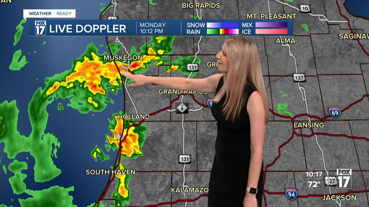


WEST MICHIGAN — The forecast from FOX 17 Weather Ready Meteorologist Kara James: Scattered showers and storms continue overnight ahead of a low pressure system and cold front. Rumbles of thunder, lightning, and heavy downpours are the main threats, along with occasional 30 mph wind gusts. Severe storms are not expected. These continue through tomorrow morning, with some along the lakeshore nearing a half in inch of rain before we dry out. All of this moisture comes with a cold front, dropping dew points into the 50s for a comfortable midweek. The only chance for rain beyond Tuesday morning is light rain Saturday AM with another front, and temperatures in the longer term look to be a bit of a "Fall preview"! On the tropical front, we are tracking Hurricane Erin. Stay tuned to the FOX 17 Weather Ready Team for your latest forecast updates.
TONIGHT: Showers and thunderstorms. Lows in the mid to upper 60s. Winds: SE 5-15 mph
TUESDAY: Morning showers and storms ending after noon. Highs in the lower 80s.
WEDNESDAY: Partly cloudy. Pleasant. Highs around 80.
THURSDAY: Mostly sunny. Pleasant. Highs in the low-mid 80s.
FRIDAY: Mostly sunny. Pleasant. Highs in the mid-80s.
SATURDAY: Mostly sunny. Pleasant. Highs in the mid-80s.
SUNDAY: Mostly sunny. Pleasant. Highs near 80.
For the latest details on the weather in West Michigan, head to the FOX 17 Weather page.
Follow FOX 17: Facebook - X (formerly Twitter) - Instagram - YouTube
