
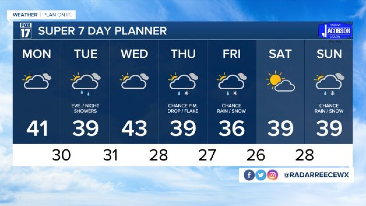


The forecast from FOX 17 Meteorologist Reece Cole: Clouds will increase into Monday morning, allowing for temps to remain seasonal in the upper 20s to around 30 degrees overnight. Temperatures will push to around 40 on Monday before another system arrives late in the day. A light rain/snow mix is possible Monday afternoon/evening, but any precipitation will be meager. Another chance for light rain/snow arrive Wednesday morning, but many areas may miss out. Our best chance for more widespread rain/snow showers comes in Thursday P.M. into Friday with another stronger system tracking through the southern Great Lakes and Ohio Valley. It's possible we could see some accumulating snow from this one, but the exact track and temperature profile as we draw closer will be factors in that and may change. Early indications are that temperatures are expected to remain near normal through mid December and perhaps leading up to Christmas. That means a "white Christmas" may be difficult unless the pattern shifts to something colder. Make sure to stay up on later forecasts! Stay with the FOX 17 Weather Team. Download the free FOX 17 Weather App for the latest forecast video.
TONIGHT: Mostly clear, not as cold. Lows in the upper 20s. Winds southwest at 5 to 15 mph.
MONDAY: Some early morning sunshine possible, otherwise becoming mostly cloudy with a rain/snow mix possible by late afternoon and into the evening. Highs around 40. Winds south-southwest at 7 to 14 mph.
TUESDAY: Mostly cloudy. Highs in the upper 30s.
WEDNESDAY: Mostly cloudy. Chance of light morning rain/snow showers. Highs in the lower 40s.
For the latest details on the weather in West Michigan, head to the FOX 17 Weather page.
