

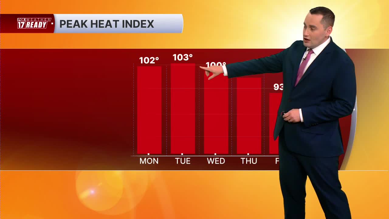


WEST MICHIGAN — The forecast from FOX 17 Weather Ready Meteorologist Colton Cichoracki: A major heat wave is going to begin Monday and it will last all week. The National Weather Service has issued an Extreme Heat Warning for all of West Michigan. This will begin at 2 p.m. Monday and last through Thursday. Expected high temperatures will be in the low to mid 90s through Friday with heat index values (feels like) 100-105 degrees each day because of extremely high humidity levels. Monday through Friday have FOX 17 Weather Ready Alerts. Make sure you drink plenty of water, limit time outdoors, wear bright colored clothing, and take care of your pets during this heat. In addition to this heat, there will be a few chances for storms. The first chance will come late Sunday night into early Monday morning. The Storm Prediction Center does have far northwestern sections in a level one marginal risk for severe storms. A complex of storms will form to our northwest Sunday afternoon and these will move into West Michigan late. These will likely be weakening as they do so but still some rain and storms are possible. The other chances will be later into the week with some isolated storms Friday into Saturday. At this point, no washout is expected for the 4th of July.
TONIGHT: Chance showers and thunderstorms, otherwise partly cloudy. Lows in the upper 60s near 70. Wind SE at 5-10 mph.
MONDAY: Weather Ready Alert: Chance A.M. showers or storms, then turning partly cloudy. Hot and humid, Highs in the low 90s and heat index around 100 degrees.
TUESDAY: Weather Ready Alert: Mostly sunny, hot and humid. Highs in the low/mid 90s and heat index around 100+ degrees.
WEDNESDAY: Weather Ready Alert: Mostly sunny, hot and humid. Highs in the low/mid 90s and heat index around 100+ degrees.
THURSDAY: Weather Ready Alert: Mostly sunny, hot and humid. Highs in the lower 90s and heat index around 100+ degrees.
FRIDAY: Weather Ready Alert: Partly to mostly cloudy with chance showers and thunderstorms. Hot and humid, Highs in the low 90s and heat index around 100 degrees.
SATURDAY (Independence Day): Chance showers and thunderstorms with highs around 90.
SUNDAY: Partly cloudy with a slight chance for a thunderstorms. Highs in the upper 80s.
Want alerts when inconvenient or severe weather is headed your way? Download the FOX 17 Weather app and set up notifications for where you live.
For the latest details on the weather in West Michigan, head to the FOX 17 Weather page.
Follow FOX 17: Facebook - X (formerly Twitter) - Instagram - YouTube
