

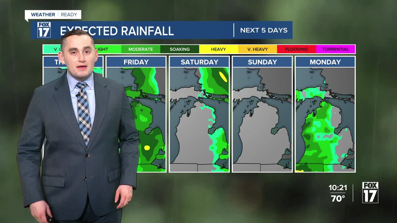


The forecast from FOX 17 Weather Ready Meteorologist Colton Cichoracki: Many places saw their first 80 degree day of the year on Thursday and cooler weather is on the way for the rest of the week. Overnight is quiet with partly cloudy skies and lows in the 60s. The main chance for rain and thunderstorms arrives on Friday ahead of a cold front. A few showers or thunderstorms are possible in the early morning, with another wave in the afternoon and early evening. Rain totals will be around half an inch or less. Temperatures remain above average into the weekend but will peak in the mid 60s instead of the 70s. Looking in to next week, a system will impact West Michigan Monday into Tuesday with more rain/storms likely. By the way...the annual Lyrid Meteor shower peaks this week. Check out the night sky if clear. Try to get away from city lights.
TONIGHT: Mostly clear to partly cloudy and mild. Chance of a shower late. Lows in the upper 50s to near 60. Winds south-southeast at 5 to 10 mph.
FRIDAY: Mostly cloudy. Chance of a few morning showers, better chance for afternoon/evening showers. Chance of thunderstorms. Severe weather not expected. Highs in the low/mid 70s. Winds southwest/west at 5 to 15 mph.
SATURDAY: Morning cloud cover, otherwise becoming mostly sunny to partly cloudy by afternoon. A bit cooler. Highs in the low/mid 60s.
SUNDAY: Mostly sunny and pleasant. Highs in the mid 60s.
MONDAY: Mostly cloudy with a chance of P.M./nighttime showers/storms. Highs in the upper 60s.
TUESDAY: Lingering showers early, otherwise mostly cloudy and cooler. Highs in the low 60s.
WEDNESDAY: Mostly cloudy. Highs in the upper 50s to around 60.
THURSDAY: Mostly cloudy. Highs in the upper 50s.
Want alerts when inconvenient or severe weather is headed your way? Download the FOX 17 Weather app and set up notifications for where you live.
For the latest details on the weather in West Michigan, head to the FOX 17 Weather page.
Follow FOX 17: Facebook - X (formerly Twitter) - Instagram - YouTube
