
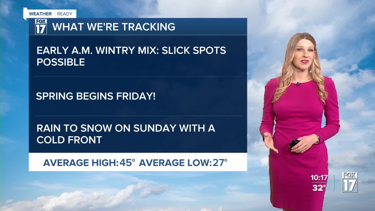


The forecast from FOX 17 Weather Ready Meteorologist Kara James: Tonight will be mostly cloudy and chilly, with lows around 30. A wave of snow and freezing drizzle is likely in the early morning before the morning commute, so there will be some slick spots on the roads. A few raindrops later in the day are possible too, but the second half of the day should be dry with temperatures close to average for this time of year (mid 40s). Thursday is also the start of warmer and quieter weather. This happens just in time for the official start to Spring on Friday! It's what we call the vernal equinox and officially arrives at 10:46 A.M.. It's the exact time the sun is directly overhead of the equator. It also marks the start of Fall for the southern hemisphere. Temperatures warm into the 50s Friday and Saturday before a cold front Sunday brings the chance for wintry mix, and falling temperatures. There are no major weather systems on the horizon.
TONIGHT: Mostly cloudy. Chance of patchy freezing drizzle. Lows around 30. Winds southwest/west at 5 to 10 mph.
THURSDAY: Light freezing rain or freezing drizzle in the morning, otherwise mostly cloudy with the chance of light rain showers. Warmer with highs in the middle 40s. Winds light/variable.
FRIDAY: Mostly cloudy. Slight chance of light rain. Highs in the lower 50s.
SATURDAY: Mostly sunny to partly cloudy. Highs in the upper 50s.
SUNDAY: Mostly cloudy. Chance or rain/snow showers. Highs in the lower 50s.
MONDAY: Partly cloudy and cooler. Highs in the lower 40s.
TUESDAY: Partly cloudy to partly sunny. Highs in the mid/upper 40s.
WEDNESDAY: Mostly cloudy with highs in the upper 40s.
For the latest details on the weather in West Michigan, head to the FOX 17 Weather page.
Follow FOX 17: Facebook - X (formerly Twitter) - Instagram - YouTube
