


The forecast from FOX 17 Weather Ready Meteorologist Colton Cichoracki: A cold front has brought much cooler and less humid air into West Michigan. This cool down will last for a few days before temperatures rebound for the holiday weekend. Tonight temperatures will fall into the 40s on the back side of the front. Quieter and cooler weather will settle in for the second half of the week. High temperatures will be back into the 60s Wednesday through Friday, with mornings lows in the 40s. The Memorial Day Weekend looks mainly dry and increasingly warm, with a few showers Saturday morning.
TONIGHT: Variably cloudy, cooler, and less humid. Lows in the mid/upper 40s. Winds west/northwest at 5 to 15 mph.
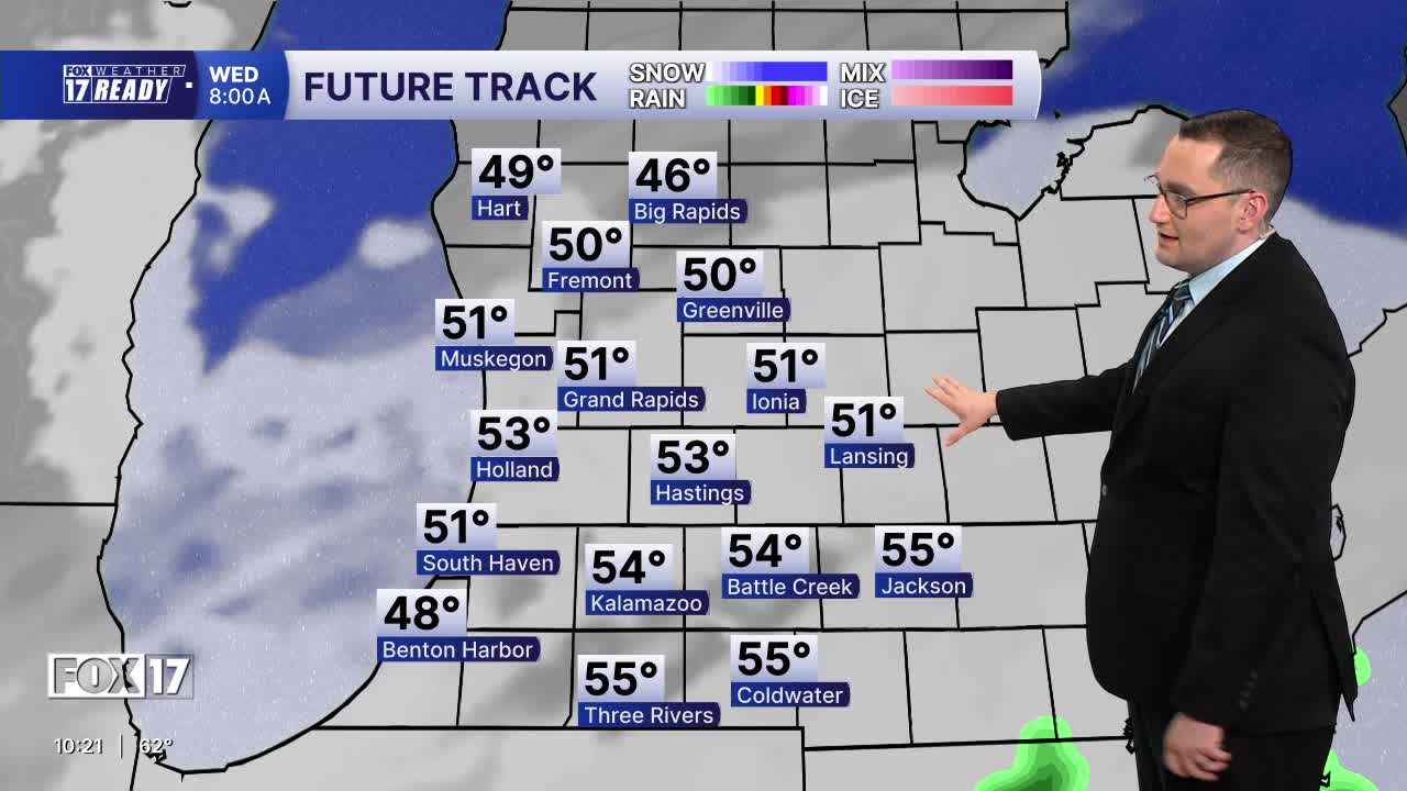
WEDNESDAY: Morning clouds, but becoming mostly sunny to partly cloudy, cooler, and less humid. Highs in low/mid 60s. Winds north at 5 to 15 mph.
THURSDAY: Partly cloudy and cool. Highs in the mid 60s.
FRIDAY: Morning sunshine, but increasing clouds. Chance of P.M. and nighttime showers. Highs in the mid/upper 60s.
SATURDAY: Chance of morning showers, otherwise mostly cloudy. Highs in the upper 60s.
SUNDAY: Partly cloudy. Highs in the middle 70s.
MEMORIAL DAY: Partly sunny and warmer. Highs in the mid/upper 70s.
TUESDAY: Mostly cloudy and warmer. Highs in the upper 70s.
Want alerts when inconvenient or severe weather is headed your way? Download the FOX 17 Weather app and set up notifications for where you live.
For the latest details on the weather in West Michigan, head to the FOX 17 Weather page.
Follow FOX 17: Facebook - X (formerly Twitter) - Instagram - YouTube
