
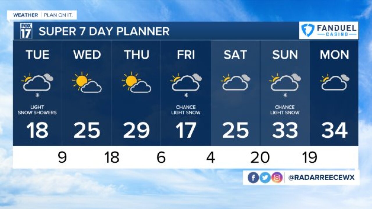


WEST MICHIGAN — The forecast from FOX 17 Meteorologist Reece Cole: Grand Rapids has eclipsed its seasonal snowfall average of 77.6", seeing 80.4" through January 29. Lake effect snow will turn light for the start of the work week today as much cooler air settles in the next two days. Snow accumulations will be light both today and Tuesday. With that, Grand Rapids will end with about 13" of snow for the month of January, about 10" below average, but still way ahead on the season total. Overnight lows will be in the single digits multiple nights this week, starting tonight as temps fall to below 0° for some locations, especially east of US-131. This will be the first time locations in West Michigan fall below zero this season. Wind chills are expected to be below zero across the area and near 10 below zero areas inland. Temps rebound Wednesday and Thursday, before another cold front Thursday night keeps Friday in the teens again. Remember to bundle up! Stay tuned for updates and download the free FOX 17 Weather App for the latest forecast video.
TONIGHT: Cloudy with light lake effect flurries possible. Areas inland will have breaks in the clouds, meaning cooler temps. Lows in the lower single digits to near zero. Winds west at 5 to 10 mph.
TUESDAY: Mostly cloudy, few lake effect flurries or snow showers possible. Highs in the upper teens to near 20. Winds southwest at 6 to 12 mph.
WEDNESDAY: Partly cloudy to partly sunny. Highs in the mid 20s.
THURSDAY: Mostly to partly cloudy skies. Highs in the mid/upper 20s.
FRIDAY: Mostly cloudy with a chance of light snow. Highs in the upper teens.
For the latest details on the weather in West Michigan, head to the FOX 17 Weather page.
