


WEST MICHIGAN — The forecast from FOX 17 Weather Ready Meteorologist Colton Cichoracki: Another cool night is ahead, but not as cold as what we woke up to this morning. Lows drop into the mid to upper 40s, but it stays breezy this evening and overnight. The cool and breezy conditions continue Friday, with highs in the upper 60s. Average highs this time of year are in the low 70s. The wind picks up tomorrow ahead of our next weather system. Widespread rain and a few rumbles of thunder are likely late Friday evening into early Saturday, with additional scattered shower chances on Sunday. Luckily, neither day is looking like a wash out and there will be plenty of dry time both days. Saturday will be the coolest weekend day with highs in the upper 60s. We warm into the low/mid 70s Sunday, and to around 80 on Memorial Day. Warmer days in the 70s and 80s continue into the middle of next week.
TONIGHT: Partly to mostly cloudy. Lows in the mid 40s. Winds E/NE at 10-15 mph with gusts to 20 mph.
FRIDAY: Morning sunshine, then increasing clouds. P.M. and nighttime showers likely. Highs in the mid/upper 60s. Windy, winds E at 15-25 mph.
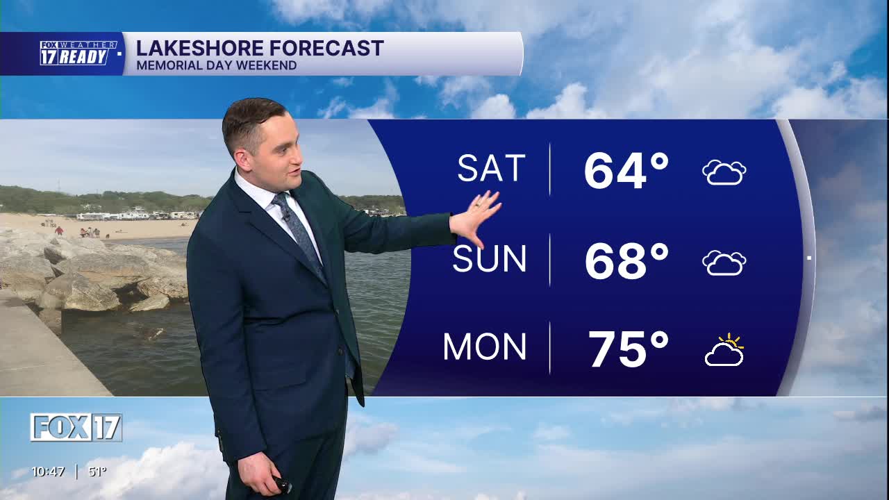
SATURDAY: Morning showers, otherwise mostly cloudy. Highs in the upper 60s.
SUNDAY: Mostly to partly cloudy. Chance of a few showers. Highs in the mid 70s.
MEMORIAL DAY: Partly cloudy to mostly sunny and warm. Highs in the upper 70s around 80. Great outdoor weather!
TUESDAY: Partly cloudy and warm. Highs around 80.
WEDNESDAY: Partly cloudy with chance showers. Highs in the upper 70s.
THURSDAY: Mostly sunny. Highs in the middle 70s.
Want alerts when inconvenient or severe weather is headed your way? Download the FOX 17 Weather app and set up notifications for where you live.
For the latest details on the weather in West Michigan, head to the FOX 17 Weather page.
Follow FOX 17: Facebook - X (formerly Twitter) - Instagram - YouTube
