
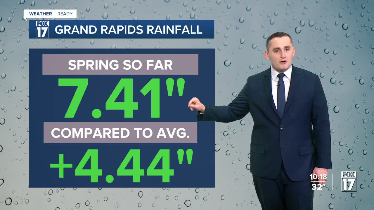


WEST MICHIGAN — The forecast from FOX 17 Weather Ready Meteorologist Kara James: A quick cold front this evening brings a few showers or rain mixed with wet snow, with no accumulation or impacts likely. Behind this cold front is some very cold air, and temperatures will fall into the low 20s overnight with breezy northwest winds. Expect wind chills in the teens Tuesday morning, brrr! A cold Canadian high pressure moves overhead tomorrow, calming the winds with a lot of sunshine. Highs will stay in the low 40s, so keep a jacket and gloves around for the West Michigan Whitecaps home opener! We start to warm back up on Wednesday as wind switches from the south, and stay warm through the rest of the week. Rain chances return Thursday and Friday, with more unsettled weather likely during the late weekend and early next week.
TONIGHT: Partly cloudy and cold. Lows in the lower 20s and wind chills in the teens. Wind: North 10 - 15 mph, gusts to 20 mph.
TUESDAY: Mostly sunny and quiet. Coldest day of the week with highs around 40. Winds light/variable.
WEDNESDAY: Mostly cloudy and breezy. Highs in the mid to upper 50s.
THURSDAY: Chance rain showers and breezy. Highs in the low 60s.
FRIDAY: Chance morning rain showers, then becoming partly sunny. Highs around 60.
SATURDAY: Mostly cloudy. Highs in the upper 50s.
SUNDAY: Chance showers and warm. Highs in mid/upper 60s.
MONDAY: Chance showers and warm. Highs in the upper 60s.
Follow FOX 17: Facebook - X (formerly Twitter) - Instagram - YouTube
