
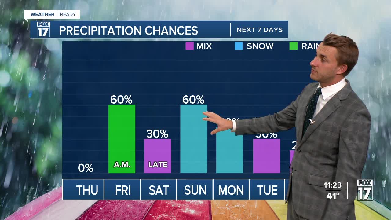


The forecast from FOX 17 Weather Ready Meteorologist Reece Cole: Expect clearing skies into Thursday with morning sunshine and lows near freezing. Thursday afternoon, clouds increase with highs in the low 50s. Friday brings another clipper, and this one has more moisture so expect a decent quarter to third of an inch Friday morning. Highs Saturday are only in the middle 40s ahead of an approaching low. This brings a sharply colder air mass by Sunday, with the potential for slushy snowflakes to mix in with rain. The "average" first snow in Grand Rapids is November 8, so this would be right on schedule. Accumulations are possible. Even though there's no significant snow in the forecast anytime soon, the Odd-Even Parking Rules are now in effect in Grand Rapids. Stay with the FOX 17 Weather Ready Team for your latest forecast updates.

TONIGHT: Mostly clear and cold. Lows in the mid 30s. Winds west-northwest at 5 to 10 mph.
THURSDAY: Morning sunshine, but increasing clouds through the day. Highs in the lower 50s. Winds southwest at 5 to 10 mph.
FRIDAY: Cloudy with morning rain showers likely. Highs in the mid 50s.
SATURDAY: Partly sunny to mostly cloudy and cooler. Chance of P.M./night rain/snow showers. Highs in the mid/upper 40s.
SUNDAY: Mostly cloudy and cold with the chance of rain/snow showers. Highs only around 40.
MONDAY: Partly sunny to mostly cloudy and cold with a chance of lake effect snow showers, mainly along/west of U.S. 131. Highs only in the upper 30s.
TUESDAY: Mostly cloudy and chilly with highs around 40.
For the latest details on the weather in West Michigan, head to the FOX 17 Weather page.
Follow FOX 17: Facebook - X (formerly Twitter) - Instagram - YouTube
