


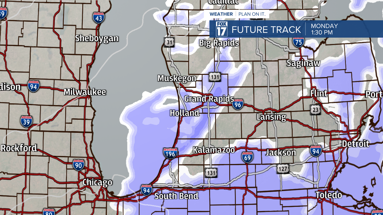
WEST MICHIGAN — After rounds of light snow in West Michigan this weekend, another system is on track for early Monday morning. Widespread snow showers are in the forecast, which is likely to create slick travel conditions during your early morning commutes.
The system moves in around 7 a.m. Monday morning, slowly moving towards the southeast.

Snow showers become the most widespread in the early afternoon, before changing over to lake effect snow by Monday evening.
Lake effect snow showers will line up along and towards the west of U.S. 131 in the evening hours, when the winds shift coming from the northwest. This is where the highest snow accumulation totals are expected, mainly along the immediate shoreline.
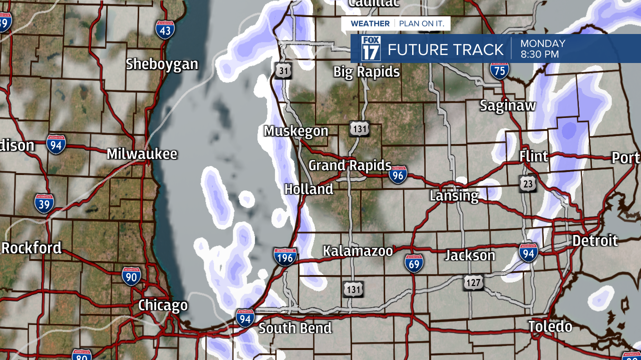
All-in-all, an additional widespread 2 to 4 inches of snowfall is anticipated with this passing system on Monday. Due to lake effect snow banding, isolated locations along the shoreline could receive isolated higher amounts.

Since temperatures are so cold, the snowflakes are likely to be very fine and light. This will allow for slippery roadways all day on Monday. There are additional chances for snow showers this upcoming week. Stay tuned with the FOX 17 Weather Team for updates.

