


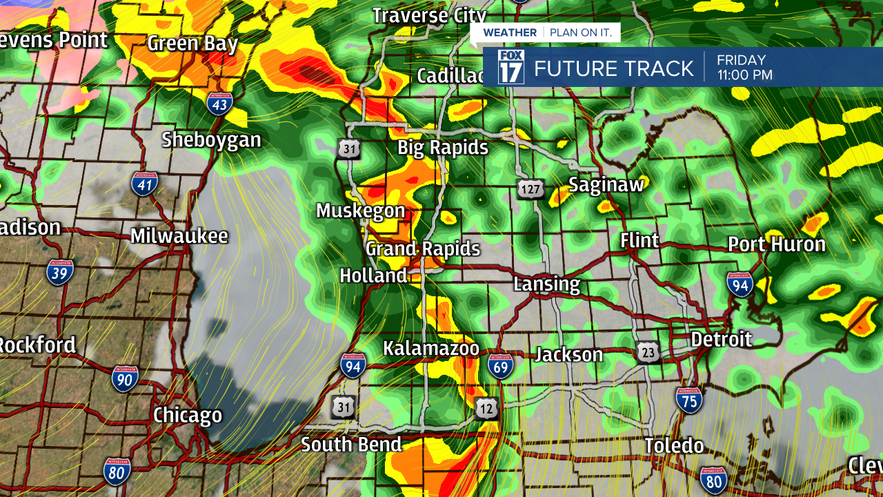
WXMI — Severe Thunderstorm Warnings and a Tornado Watch (Berrien County) have been popping up across West Michigan this evening and tonight. Hail reports the size of a golf ball have been reported in Sturgis, along with various other hail reports across West Michigan. Heavy rain could create flooding in parts of the region, along with strong wind gusts.
Showers and thunderstorms will remain on-and-off through tonight. The potential threats with these remaining storms will be strong wind gusts, hail, frequent lightning, and heavy downpours. An isolated tornado can't be ruled out.
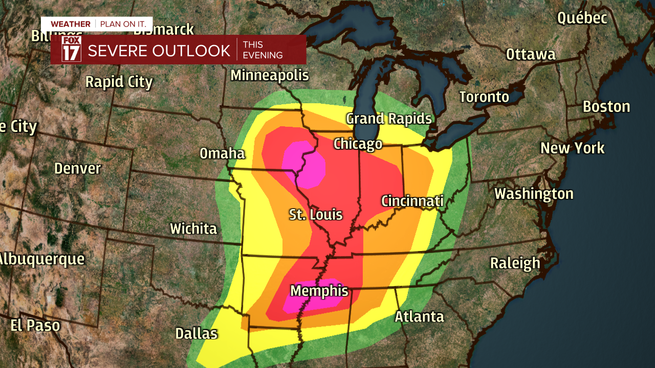
The Storm Prediction Center has placed parts of West Michigan under a risk for strong to severe storms on this evening. In order for a thunderstorm to be considered severe, it must meet the criteria of winds reaching 58 mph or higher, and/or hail at 1" in diameter or larger. See image below. The threat for severe weather has increased for the region from Muskegon, to Grand Rapids, to Lansing, and just east of Jackson. This is a threat two out of five! The primary threat for these storms includes wind gusts up to 60 mph and hail. An isolated tornado can't be ruled out. Notice that extreme Berrien and southwestern Cass County are now in an ENHANCED RISK...level three out of five! Lesser chances exist in the area of green.

The greatest threat for severe storms will be through Illinois, Iowa, Tennessee, and Arkansas. Those states fall squarely under a MODERATE to ENHANCED RISK for strong to severe storms. The primary threats in these locations will be strong, damaging wind gusts, large hail, and tornadoes.
If you're a fan of the heat and thunderstorms, don't get too comfortable. Colder air begins wrapping into West Michigan on Saturday, transitioning rain back over to snow.

Any snow accumulation in our region will be minor, with the majority of accumulation in Northern Michigan. At this point, the majority of West Michigan will see under one inch of snow accumulation Saturday. In addition to cooler air and snowflakes, the winds will be howling on Saturday! Wind gusts up to 55 mph are possible...especially at the lakeshore. A WIND ADVISORY has already been issued for our southern counties, but that will likely be extended to our lakeshore counties.

Stay tuned with FOX 17 for your latest forecast updates. If any alerts are issued in West Michigan, the FOX 17 Weather Team will notify you immediately. You can download the FOX 17 Weather App and visit www.fox17online.com/weather/ for more information.
