


WEST MICHIGAN - Similar to last week, another powerful fall storm will impact the Great Lakes tonight into Thursday morning. This system will bring unseasonably warm temperatures, near record levels in fact, but wind will be the primary threat.
Breezes will ramp up a bit today as the system draws closer to Michigan. We expect southeast/south winds at about 10 to 20 mph, with winds increasing even more tonight. See image below valid 6 P.M. Wednesday.

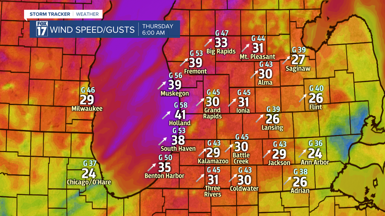
The core of the strongest wind will likely occur late tonight into daybreak Thursday with sustained speeds of 20 to 30 mph and gusts of 50 to 60 mph possible. See image below valid for 6 A.M. Thursday.
Wind speeds stay strong through most of Thursday, but will diminish slightly by the afternoon. See image below valid for 6 P.M. Thursday.

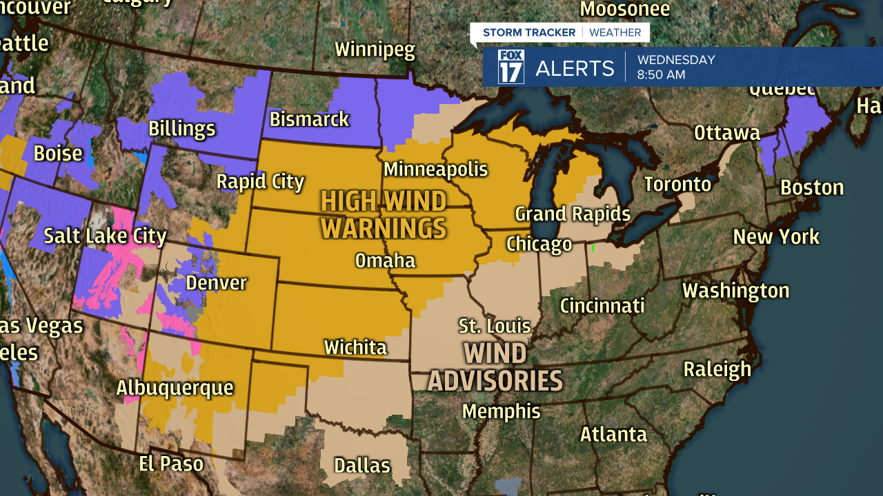
A HIGH WIND WARNING has been issued for Ottawa, Muskegon, Oceana, Newaygo, and Mecosta counties from 7 P.M. this evening through 4 P.M. Thursday. Everyone else is under a WIND ADVISORY from 7 P.M. this evening through 4 P.M. Thursday. Gusts to 60 or so likely in the warning area, while gusts from 50 to 55 in the advisory area. See image below.

The scope of this system is huge. Take a look below at all the states that are under either a HIGH WIND WARNING or WIND ADVISORY.
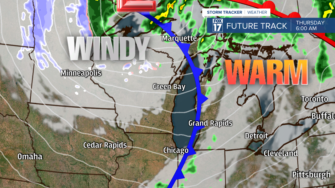
Our forecast model shows the powerful low pressure system moving into the Upper Midwest and the location of it. See image below valid for 6 P.M. Wednesday. A warm front will lift through the area Wednesday evening. We expect near record warmth around 60 by 10 or 11 P.M. Wednesday evening.

By Thursday morning, we're still ahead of this system in the warm sector with a few scattered showers possible. Near record warmth is possible in the lower 60s Thursday morning, before falling through the day behind the cold front. Windy conditions continue through the day as well.
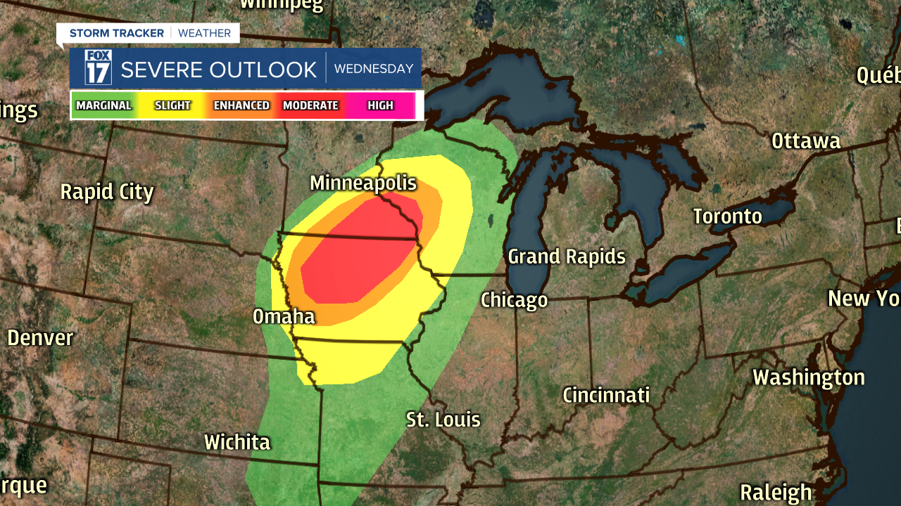
In addition to powerful winds, this system will spawn another round of strong to severe thunderstorms across parts of the Midwest, although likely not as severe or widespread as last week with the historical tornado outbreak. See Storm Prediction Center outlook for today and tonight below.
Make sure to stay up on later forecasts. Get all of your complete West Michigan details at www.fox17online.com/weather.
