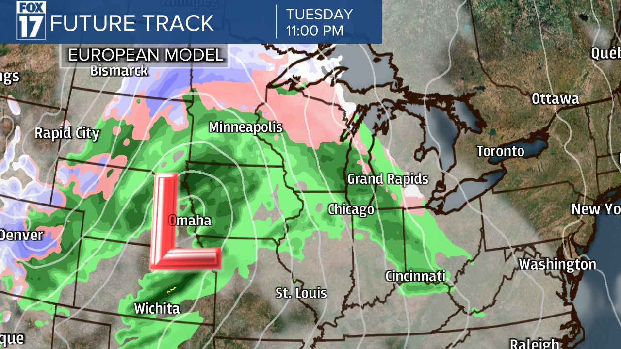
WEST MICHIGAN — Keep your rain gear and warm layers handy! The FOX 17 Weather Team is currently tracking an incoming system, expected to arrive to West Michigan late Tuesday night. Forecast models are indicating mixed precipitation initially on Tuesday night, with a mix of rain, freezing rain, and snowflakes. That will progress into Wednesday morning as temperatures remain cooler and near the freezing point.
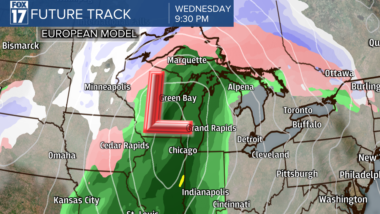
As temperatures increase through the day on Wednesday, reaching the middle 50s, precipitation will transition over to only rain showers. There's even a chance West Michigan could see a few thunderstorms late Wednesday evening.
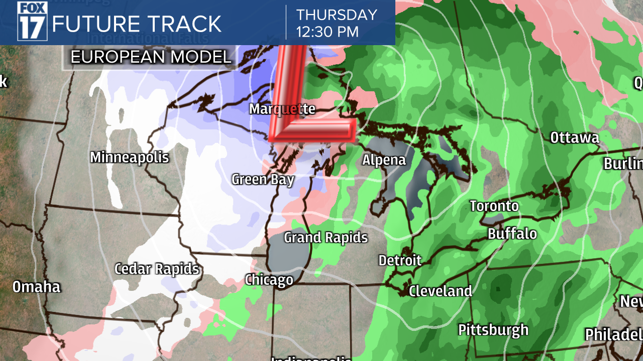
Rain showers continue into Thursday, before cooler air sweeps back into the region. Rain will transition back to snow showers late Thursday into Friday, although any accumulation is expected to be minor at this point. High temperatures on Friday are back in the 30s! It will additionally be breezy on Wednesday into Thursday, as well.
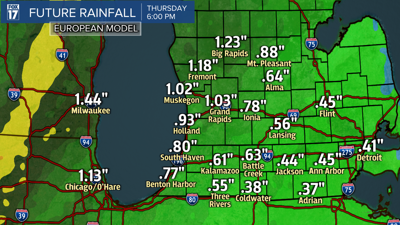
When it comes to the amount of rainfall, the latest European model suggests half an inch to about one inch of accumulation. Stay tuned with FOX 17 for your latest forecast updates. The exact timing, how much rainfall, and how much snowfall are all subject to change as this system draws closer.