


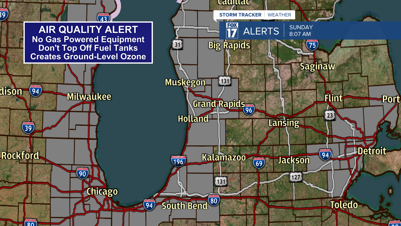
WEST MICHIGAN - Our continued hot and dry conditions have prompted another AIR QUALITY ALERT day for most of West Michigan. What does it mean? Simply put, authorities have asked for voluntary cooperation from residents to not use gas-powered lawn equipment today. Things like lawnmowers, weed-wackers, or even topping off your fuel tank in the car is not a good idea. These things contribute to ground-level ozone formation here at the surface which creates bad breathable air quality. Much better to wait until another day to cut the grass. See image below for the counties under the ALERT.
While air quality concerns is one thing, increased fire danger is another in this hot and dry weather. We remain in a severe to moderate drought (see image below), but these continued conditions also increase our fire threat. All that, plus a stiff southerly wind continues to dry out our brush and vegetation. It's not advisable to do any burning. Although only Oceana, Newaygo, and Mecosta Counties are under the FIRE WEATHER WATCH, all locations are very dry and should exercise caution.

Take a look at the U.S. Drought Monitor below from NOAA. Despite the rain we had last week and the week before, West Michigan remains in a moderate to severe drought.

While today will be hot and dry, we'll ratchet the temperatures back to the mid 80s from Monday through Thursday with an increased chance for isolated to scattered showers and thunderstorms as a weak upper level low pressure system floats into the Great Lakes and perhaps gives us a rain chance during the heating of the day in the afternoon hours those days. Better chances for these showers/storms will be inland away from the cooler stabilizing effects of Lake Michigan. See image below from our forecast model valid for Monday afternoon at 6 P.M.

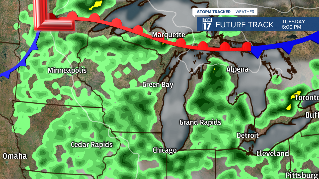
Again, in the image below valid for 6 P.M. Tuesday afternoon, more shower and storm chances (especially inland) as we heat up during the day. It's feasible only a handful of locations may see measurable precipitation, but at least we have chances for much needed rain.
Get the complete West Michigan forecast at www.fox17online.com/weather.
