
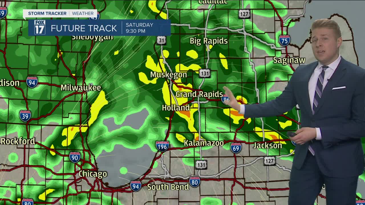


WEST MICHIGAN — After a quiet and comfortable morning with some sunshine, heavy rain showers and even a few thunderstorms will develop this afternoon. Before the rain begins, temperatures will move quickly towards 70°, making this morning the best time period to get outside for the entire weekend.
The rain and isolated storms will develop as a low-pressure rotates in our direction from the south. Storm motion will be from south to north, so the northern counties will see the warmest temperatures today. Locations north of I-96 could reach into the lower 70s, with everyone else going to 70° by the early afternoon. The rain will develop between noon and 5 pm, continuing for the remainder of the evening.

Heavy downpours and lightning will be possible for everyone today. A few storms could also produce gusty winds, but that is a low chance across the area. Rainfall amounts will be between 1/2" to 1" by Sunday morning. Flooding is not expected from this activity as the ground is still very dry and river/lake levels are not particularly high. Ponding out on the roadways, however, is possible during the heaviest rain.
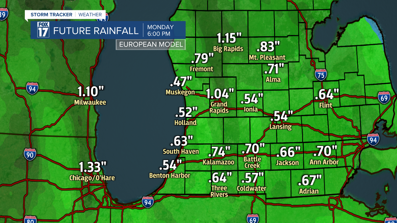
This system will slowly weaken in the area tonight and Sunday, meaning additional clouds and showers will be around through Sunday evening. Rainfall tomorrow will be less than 1/4" as the showers will be fairly light.
