
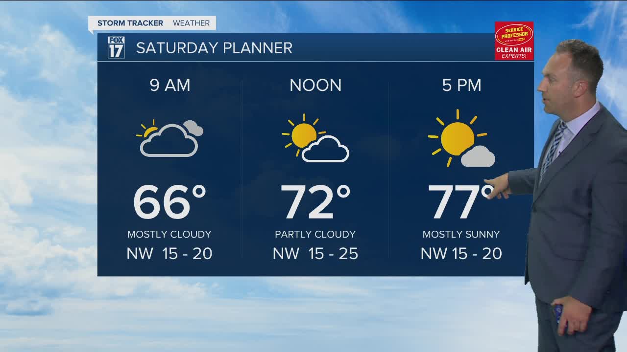


WEST MICHIGAN — A good-looking forecast is in order for this Saturday afternoon and right on into Sunday around West Michigan. Sunshine and passing clouds will be the story along with much lower humidity and cooler temperatures.
This cooler air is being brought into the region on brisk northwest winds at 10-25 mph with some higher gusts. The forecast stays completely rain-free through the weekend.
The Lake Michigan forecast is looking a little rough here on Saturday, however. The aforementioned winds will have waves between 4-6, possibly 7 feet from north to south along the shoreline within the viewing area today. The highest waves will occur for southernmost sections, say along the shores of Van Buren and Berrien counties.
We drop into the mid to upper 50s overnight tonight before heading for similar territory in the mid 70s on Sunday.
A bit warmer weather shows back up on Monday into Tuesday as temperatures head for around 80 to the low 80s once again. A good deal of sunshine is expected.
Our next weather system arrives at some point Tuesday afternoon with a chance for showers. This wet weather exits early Wednesday morning but leaves us a touch cooler on Wednesday in the upper 70s.
We look for a spike in the mercury again on Thursday with numbers hitting the lower half of the 80s. Another shot of cool air looks to arrive for Friday with highs back down into the low 70s.
The mini roller coaster continues next weekend with readings likely climbing back into the vicinity of 80 degrees.
