


WEST MICHIGAN — Most of this weekend is going to be rain-free but a slight chance for a shower/thunderstorm does exist this afternoon and through tonight.
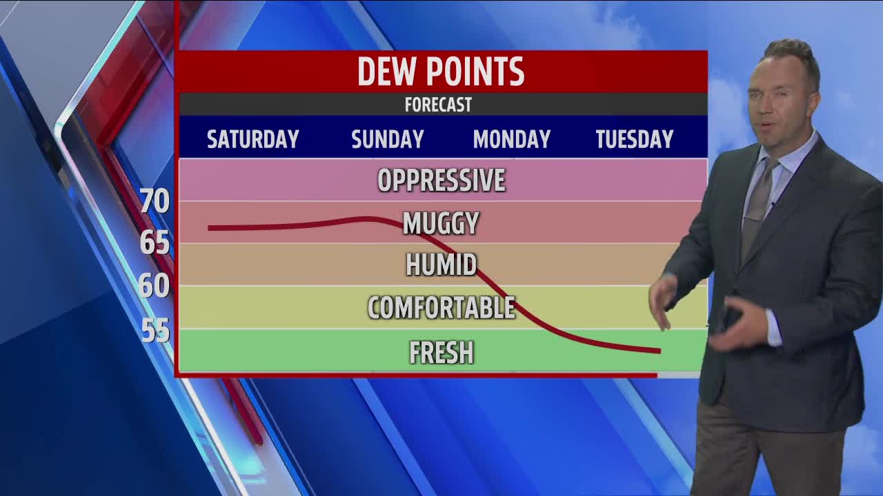
Expect an overall partly cloudy sky today with higher humidity than recent days as the mercury climbs to similar levels in the upper 80s. Heat indices will be in the lower 90s this afternoon.
Any isolated thunderstorm that does develop this afternoon or evening could provide some gusty winds so we will keep an eye on that.
As a cold front pushes through mid-late evening tonight, this will bring our best chance for a bit better coverage of showers that can be around into the overnight.
Rain amounts do not look overly impressive but a few downpours will likely be scattered around West Michigan.
Activity exits by around daybreak Sunday and some drier air works in for the afternoon. Look for a mix of sun and clouds on Sunday with highs in the lower 80s. Comfortable temperatures and low-level humidity are in the forecast for the early and middle parts of this coming workweek. Highs in the upper 70s to near 80 degrees will be the story for Monday, Tuesday, and Wednesday.
With a general trough of low pressure overhead in the upper-levels of the atmosphere, an afternoon pop-up shower cannot be ruled out into the middle of the week but certainly nothing significant nor widespread is anticipated.
A bit of warming tries to develop across the Midwest & Great Lakes region yet again as we go late week into next weekend.
