


Mother Nature is trying her best to get us back to normal for snowfall this season by throwing more our way tonight and Sunday. We remain about 3 feet below normal for snowfall on the season.
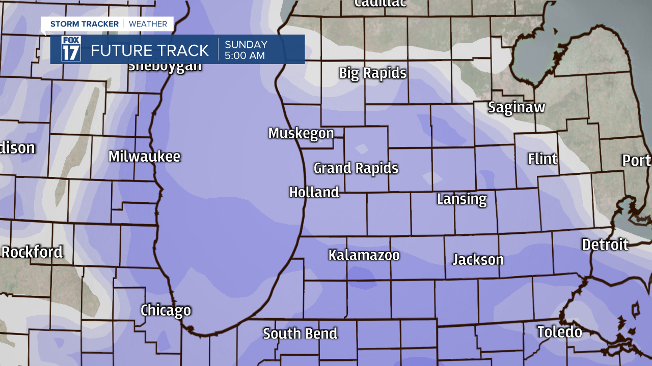
While this weekend's snow won't be anything record breaking, some spots around I-94 will approach 6" of snow by Sunday afternoon. The best way to estimate how much snow you will see is the closer you are to the Michigan-Indiana border, the more snow you will get. Winter Weather Advisories have been updated for snow and hazardous travel from Saturday evening to Sunday afternoon.

The starting time of the snow has been delayed a few hours because of lingering dry air. It will now begin a few hours before midnight for the I-94 corridor. It will expand to I-96 an hour or two after midnight. The heaviest snow will be from I-96 to the border, with just some light snow north of the interstate. The snow will be heaviest tonight into Sunday morning, with it falling apart to just a few snow showers during the afternoon. By the evening, while a few flurries remain possible, accumulating snow will be over.
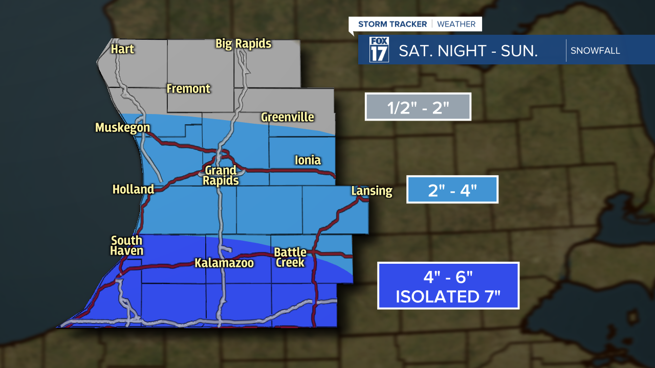
Snow amounts will be 4" to 6" for those around I-94 and south to the border. Those that have the best chance of 6", with isolated amounts around 7", will be in Berrien, Cass, St. Joseph and Branch counties. Between I-94 and I-96, 2" to 4" is expected. If you live north of I-96, your snow amounts will be fairly light, with you only receiving 1/2" to 2" of powder.
The biggest travels impacts from the snow will be late tonight and Sunday morning. Due to it falling apart Sunday afternoon, roads should be just fine by Monday morning. This will keep the chances of a snow day Monday low.
