


WEST MICHIGAN — The FOX 17 Weather Team is currently tracking a system arriving Thursday, expected to bring a mix of rain, some patchy freezing rain, and accumulating snow. Strong strong winds will also accompany this system. Below is a breakdown of the timing, how much precipitation, and how strong the winds will be.
Counties along and north of I-96 now fall under a WINTER WEATHER ADVISORY until 11 a.m. Thursday.

When will the system arrive?
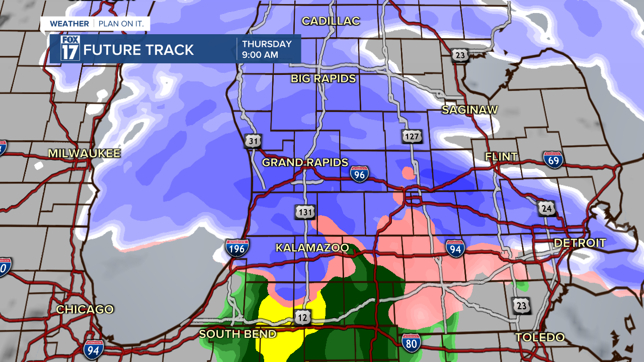
We expect arrival this morning, where rain and snow showers will overspread the area from southwest to northeast.
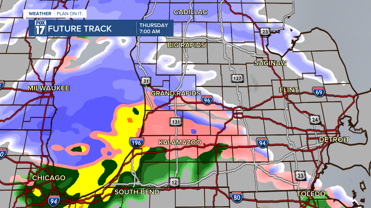
There may be some light freezing rain at the onset in some areas, but icing is not expected to become an issue at this time. Freezing rain is represented by the color pink. The region along and north of I-96 will mainly see snow, with a wintry mix south of I-96. Precipitation is expected to last into the late morning/early afternoon.

How much rain and snow?
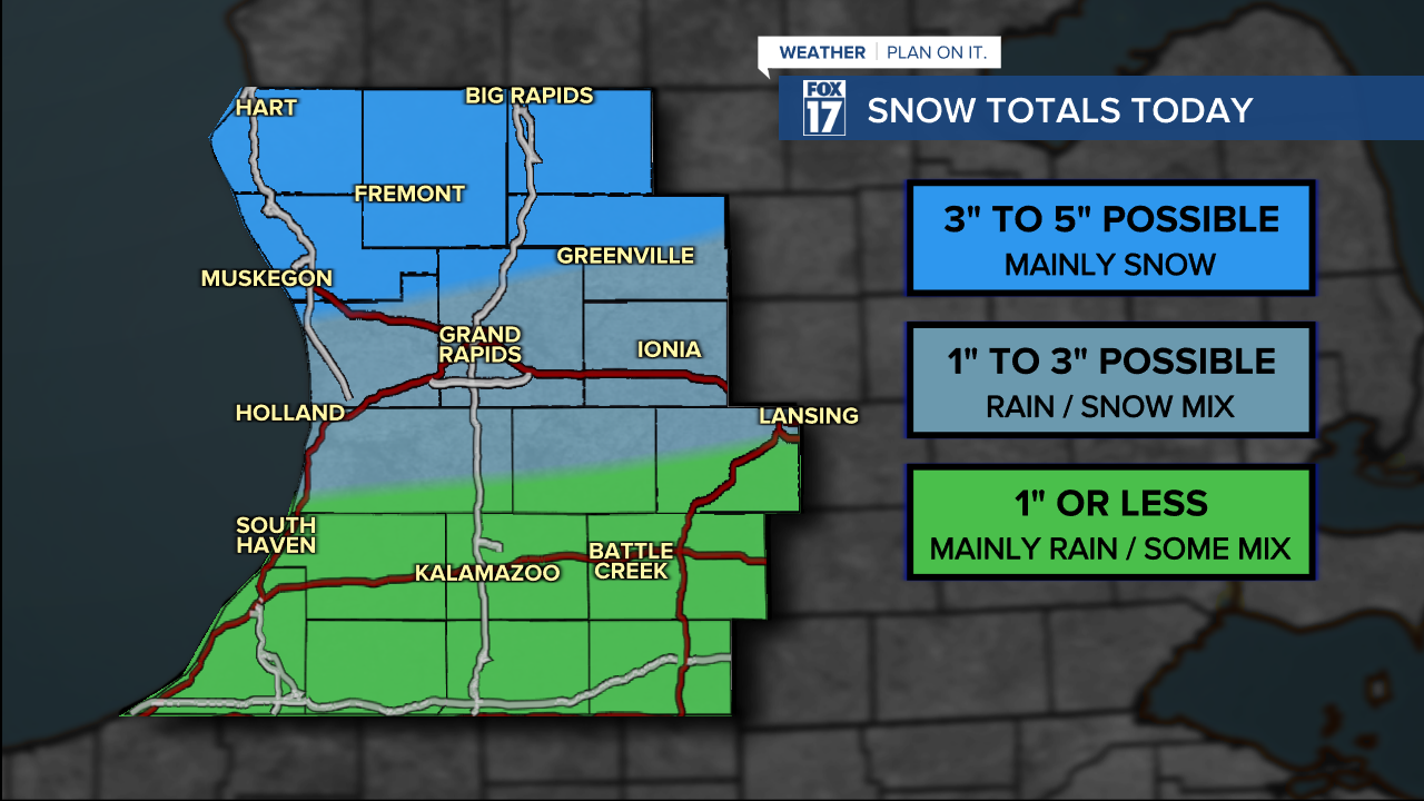
Up to a quarter inch of rain is possible in some areas before a quick transition to snow occurs. This burst of snow from we call frontogenetic forcing (or lift) will likely occur along/north of the I-96 corridor. This low pressure system is now tracking further north than our models had it on Tuesday, pushing the heaviest/steadier snow north of Grand Rapids. Forecast models are indicating anywhere from 1" to 3" will fall along and just south of the I-96 corridor, with 3" to 5" possible further north. See map below. Of course, it's possible the accumulating snow may shift slightly further north or south, depending on the exact track of the system, how fast the cold air wraps in, and how quick the changeover occurs from rain to snow. That said, we do expect more rain to mix in across our southern counties with only an inch or less of snow accumulation in these areas.
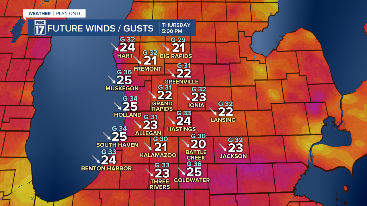
How strong will the wind be?
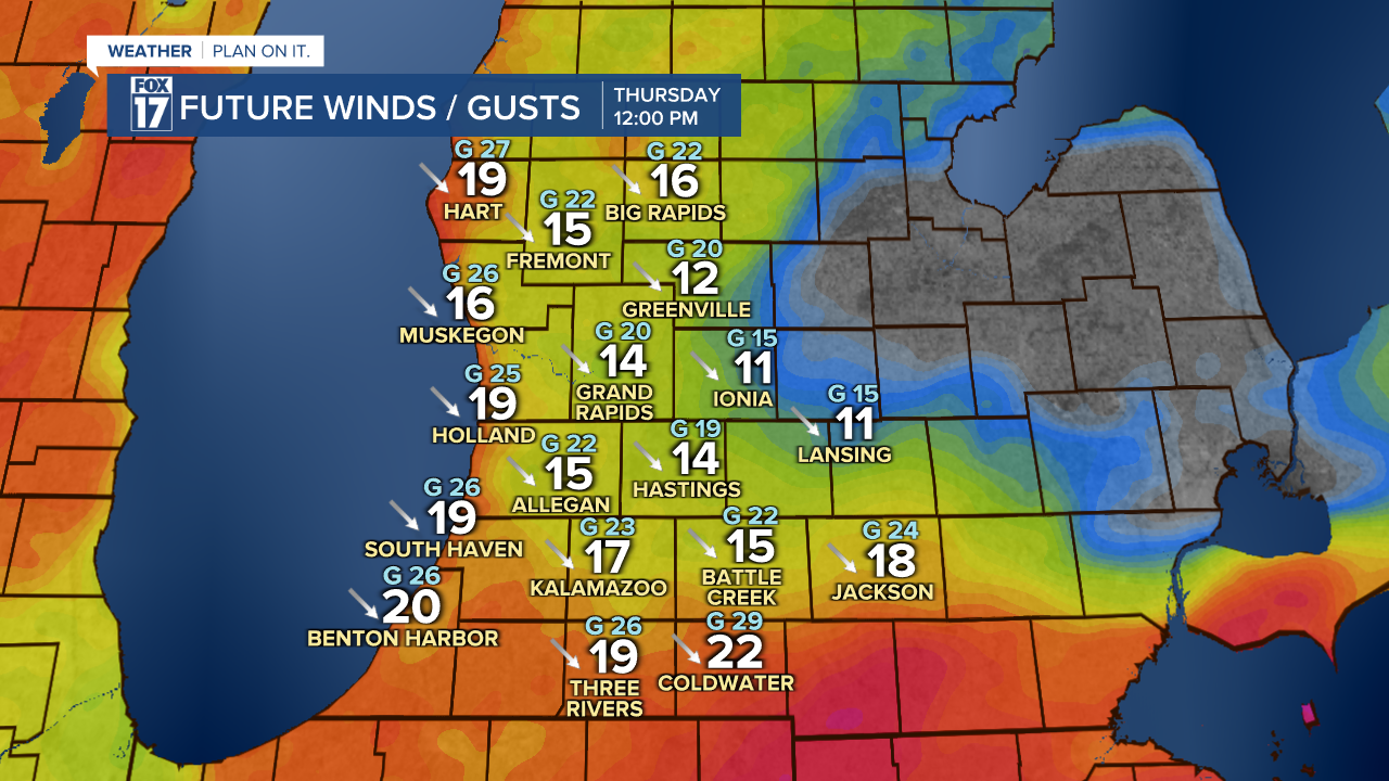
Wind speeds will be weak early in the morning, but ramp up through the day, with the peak speeds occurring in the mid/late afternoon hours. See images below. Winds will be out of the south and east early, then switch from the northwest as the low passes us by. Winds will eventually be sustained at 15 to 25 mph with gusts around 35/40 mph.

Will there be travel impacts?
We expect wet pavement for the Thursday morning commute, but the real accumulating snow may not start until the mid/late commute. Expect wet roadways for the evening commute. Get more at www.fox17online.com/weather.
