


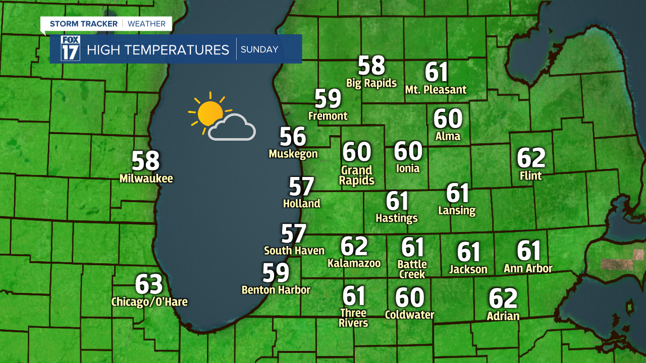
WEST MICHIGAN — Enjoy the weather we have outside today, because winter is about to make an unwanted return. Temperatures will be around 60° for our Sunday with some sunshine! This will likely be the warmest/nicest day we have until next Saturday.
Conditions begin to go downhill on Monday as a cold front moves through during the day. This will increase the clouds and produce a few rain showers for us. It will also bring chillier weather with 40s & 50s expected to start the week. The cold front will be key to snow developing Monday night, Tuesday and Tuesday night.

As the cold front sinks south of the state, a low-pressure system will develop along it and move through Indiana and Ohio. This will leave us on the colder side of the low. The temperatures behind the cold front will be supportive of some snow. Monday night into Tuesday morning, we will likely see a rain/snow mix with little to no snow expected to stick. We could have a few dry hours during the morning and afternoon before the precipitation gets going again Tuesday evening. This is when we are expecting to see mainly snow. The snow will slowly shift east Tuesday night into early Wednesday.
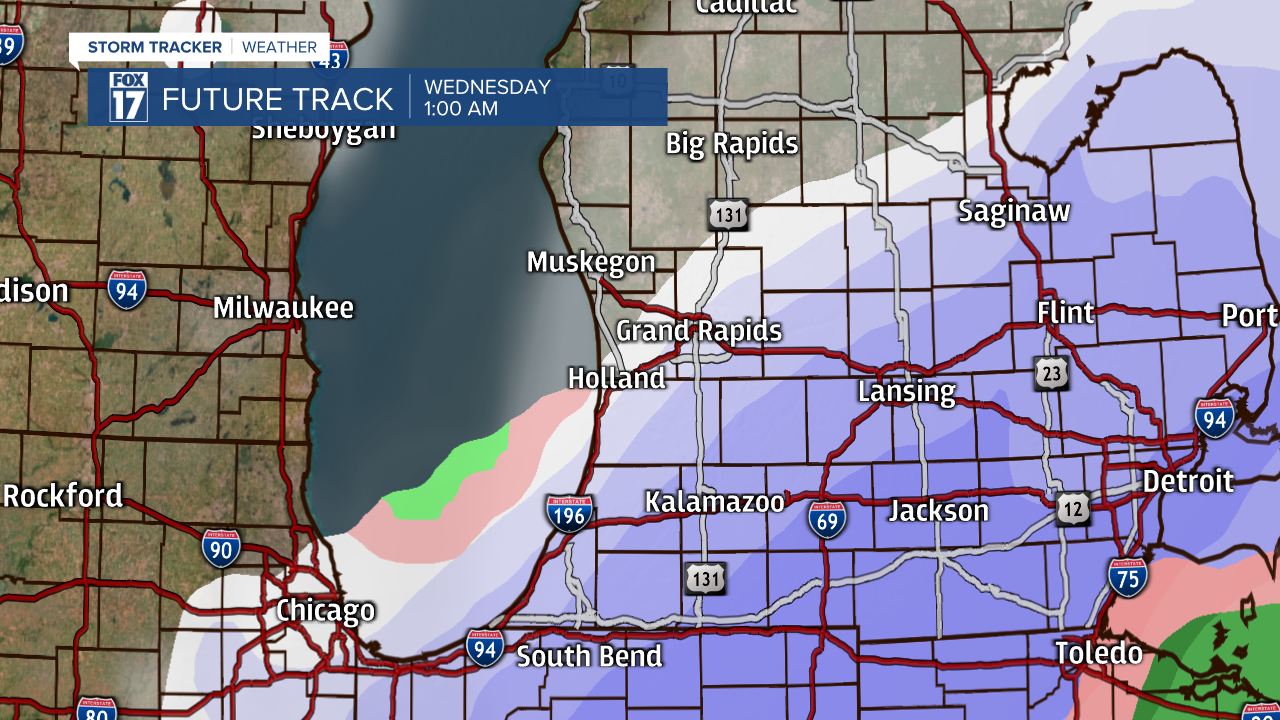
Tuesday evening and Tuesday night is when our area has the best chance of seeing the snow stick. The current thinking is the greatest opportunity for a few inches of snow will be south of I-96, particularly in the I-94 corridor. The further north you are, the less snow you will see. Some north of I-96 may not see any snow. Due to us being in mid-April now, getting snow to stick is not an easy task. High temperatures will be around 40 on Tuesday, leading to some melting. The ground temperatures are also fairly warm, so it will take some pretty heavy snow over a long period of time for it to overcome that warmth and accumulate. The heavy, wet nature of the snow will also lead to compaction, reducing snow totals.

Most of what is able to stick will be on the grass and elevated surfaces. You may have to brush some slush off of your car windshield Wednesday morning. The snow that sticks will likely completely melt by the end of Wednesday. Changes to the forecast and track of the low is still possible, so updates will follow here on fox17online.com and on FOX17 News.
