


WEST MICHIGAN — Summer is on its way back to West Michigan! We will have to get through one more day of below normal temperatures today before the warm-up begins.
If we include expected temperatures from today, which will again be below normal, West Michigan has had colder than average high temperatures for thirteen days in a row. This is definitely not a streak we want to see any time of the year, but thankfully we are about to break out of it. Temperatures today by the evening will be in the lower 50s away from Lake Michigan. Those along the lakeshore will be stuck in the 40s thanks to an onshore wind.

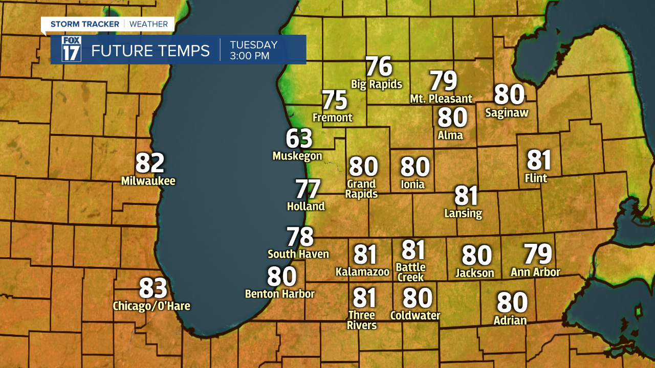
Starting Monday, a warm front is expected to move out of the plains and into the Great Lakes. This will finally push our area into above normal temperatures for a change. Readings will not be too far above average on Monday with highs in the middle 60s. Tuesday will be very summer-like with highs around 80° along with some sunshine.
The warmest day will be Tuesday as the system that brings the heat back will get close enough on Wednesday to produce showers and thunderstorms. Temperatures will still be above normal in the upper 60s to lower 70s even with the rain. The low-pressure will remain in the area on Thursday, meaning additional showers and storms. It will also be further to our east, so cooler air will return to put us back down to around normal. Rainfall on both Wednesday and Thursday will approach 1". The thunderstorm chance will also be the highest we have seen in weeks. Severe weather does not look likely with any of this activity.

