


WEST MICHIGAN — After 50s and 60s on Saturday, colder air will rush into the area today. Temperatures will be about 10 degrees colder than normal, with wind chills even worse than that. Thankfully it will only be today, at least in the short-term, that we will experience this chill. Conditions on Monday and Tuesday will be back into the 50s and 60s with some sunshine!
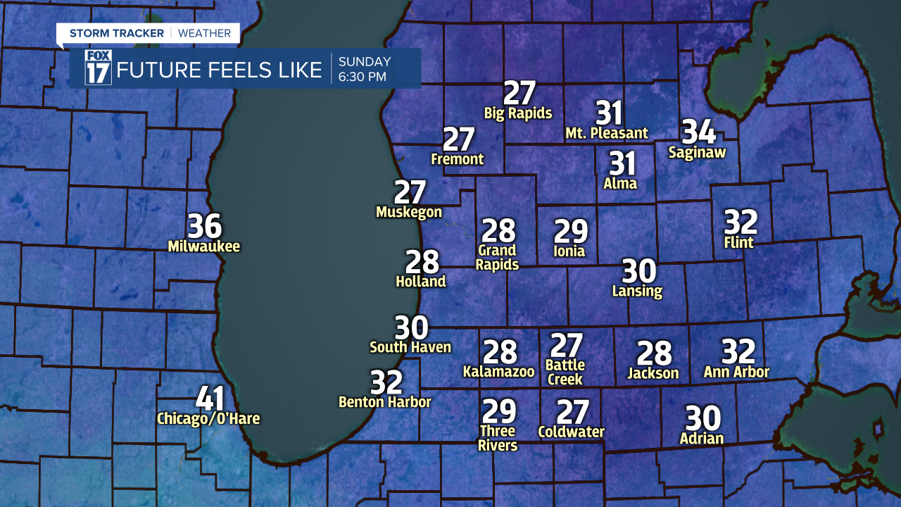
The colder air will be a result of this morning's cold front, our most recent low-pressure moving to our northeast and winds primarily out of the west and the northwest. Readings will be stuck mainly in the upper 30s, with wind chills at times in the 20s thanks to winds of 15 to 25 mph. Occasional gusts will be between 30 and 40 mph. It will be a good day to stay inside!
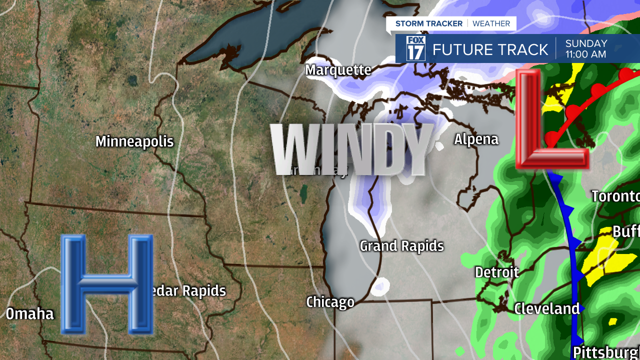
Another piece of the forecast that may also keep you inside is the chance of rain and snow. The air will be cold enough to produce some lake-effect rain and snow showers until the evening. Warm ground and air temperatures, along with the precipitation being light, will keep any snow from sticking.

This will not be our only encounter with Old Man Winter this week. On Wednesday, the cold will return with another chance of rain and snow. The chillier air will linger in the area for Thursday and Friday as well. Readings will only be in the 30s and 40s.

