


GRAND RAPIDS, Mich. — An oddity in the sky is set to return to West Michigan in 2026, as a helicopter towing a giant hexagon will be back to continue a scientific study of groundwater.
Last August, many neighbors in the Kalamazoo area spotted the hexagon dangling beneath a helicopter. FOX 17's Julie Dunmire found out it was part of an effort to survey aquifers in the state.
WATCH: What's that? How a hexagon in the sky helps scientists study groundwater
The U.S. Geological Survey says it is planning to conduct more flights with the magnetic hexagon in 2026 and 2027 to help the Michigan Water Use Advisory Council get a better grip on what liquid resources are available in the state.
The survey flights are scheduled to begin this spring and stretch into the fall in 2026. Areas where the helicopter will fly include Allegan, Barry, Berrien, Branch, Calhoun, Cass, Eaton, Hillsdale, Ingham, Ionia, Jackson, Kalamazoo, Kent, Ottawa, St. Joseph, and Van Buren counties. The below map shows the approximate area where the flights will be carried out.

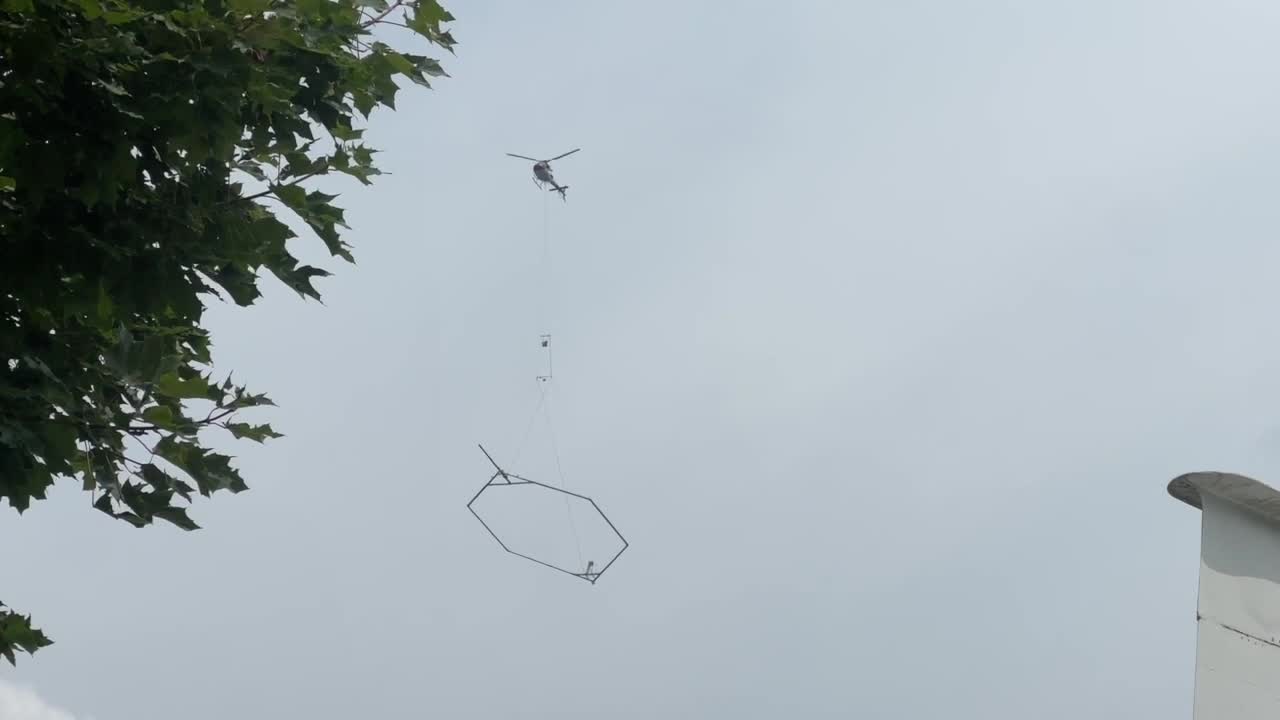
The large hexagon-shaped device can measure up to 1,000 feet beneath the earth's surface to find ground water.
"Everyone's seen the little hand metal detector. It's just a big metal detector under a helicopter," Jared Abraham, of Wyoming-based Aqua Geo Frameworks told FOX 17 in 2025.
The data collected allows scientists to build a 3D image of the area's geology, which should provide a better understanding of how water flows underground.
"We are hoping to have a 3-D, dimensional map of the subsurface, so we can look for all of the aquifers, those are the water-bearing zones inside of the earth, so we can place our production wells in them," Jean Talanda, Water Programs Manager for the City of Kalamazoo, said last year.
The helicopter flights have pre-determined grids to follow, so neighbors will see it cover the same area multiple times, said the U.S. Geological Survey. The helicopter has to fly relatively low, just a few hundred feet from the ground, but it won't fly within 500 feet of buildings and the pilot will try to avoid going over people.
The magnetic hexagon is supposed to be safe for people, plants, and animals, according to the geological survey. The electromagnetic field it generates is no more than what you experience standing near a toaster.
If you want to track the flights, the U.S. Geological Survey provides a live map showing where the helicopter is flying.
Follow FOX 17: Facebook - X (formerly Twitter) - Instagram - YouTube
