


GRAND RAPIDS, Mich. — The ongoing conversation about downtown development inevitably brings up the frequent issue of parking availability. Attempting to address the current parking options, the city of Grand Rapids is exploring a partnership with two companies to gather data regarding the existing parking situation. The innovative approach involves the use of drones for data collection.
During a recent visit to downtown, many expressed frustrations about parking, with one local noting, "It's hard to park." However, experiences can vary significantly depending on the time of day or specific location. To address these parking challenges, city officials hope to gain a comprehensive understanding of parking dynamics through aerial data collection.
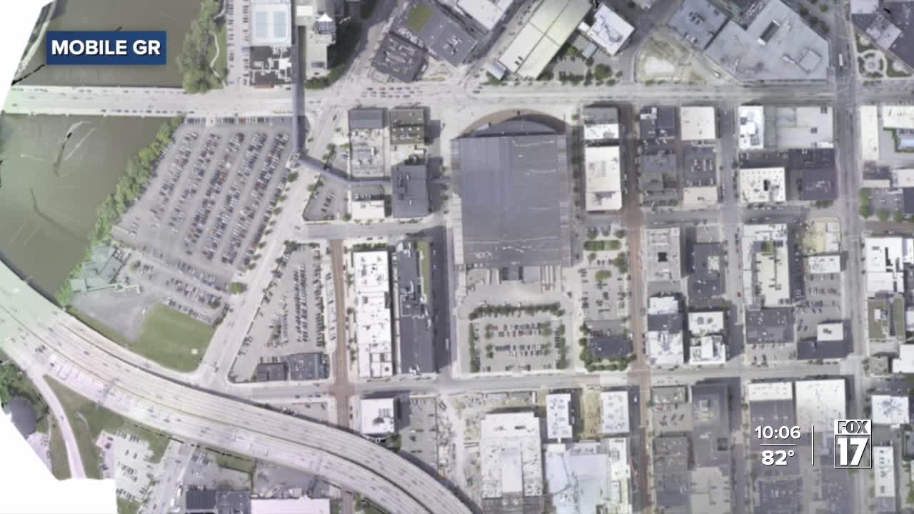
Max Dillivan, a transportation planner with Mobile GR, explained that the drones would operate from heights of 300 to 400 feet, capturing high-resolution images of parking areas below. The plan was presented to the city’s Public Safety Committee, proposing a three-week data collection period to assess parking utilization and management.
Utilizing patented technology from Quantifly, the drones will employ an algorithm that identifies vehicles based on their color and precise positioning within parking spaces. Emphasizing privacy concerns, Dillivan assured that no identifiable features, such as license plates or personal vehicle information, would be collected during this process.
The goal is to understand current and future parking demand better, enabling the development of strategies for a sustainable parking system.
On August 12th, a public hearing will offer an opportunity for residents to discuss the drone study further and seek answers to their questions.
To implement this project, the city would need to allocate approximately $180,000 for the drone study.


