


A Winter Weather Advisory is in effect through 10 P.M. Monday for all of our West Michigan counties. See image below.

Temperatures will push towards 40 degrees but feel like the upper 20s and lower 30s with gusty winds upwards of 30-40 mph. When the temperatures start to push above the freezing mark throughout the afternoon more precipitation will transition over to rain instead of wintry mix or snow.
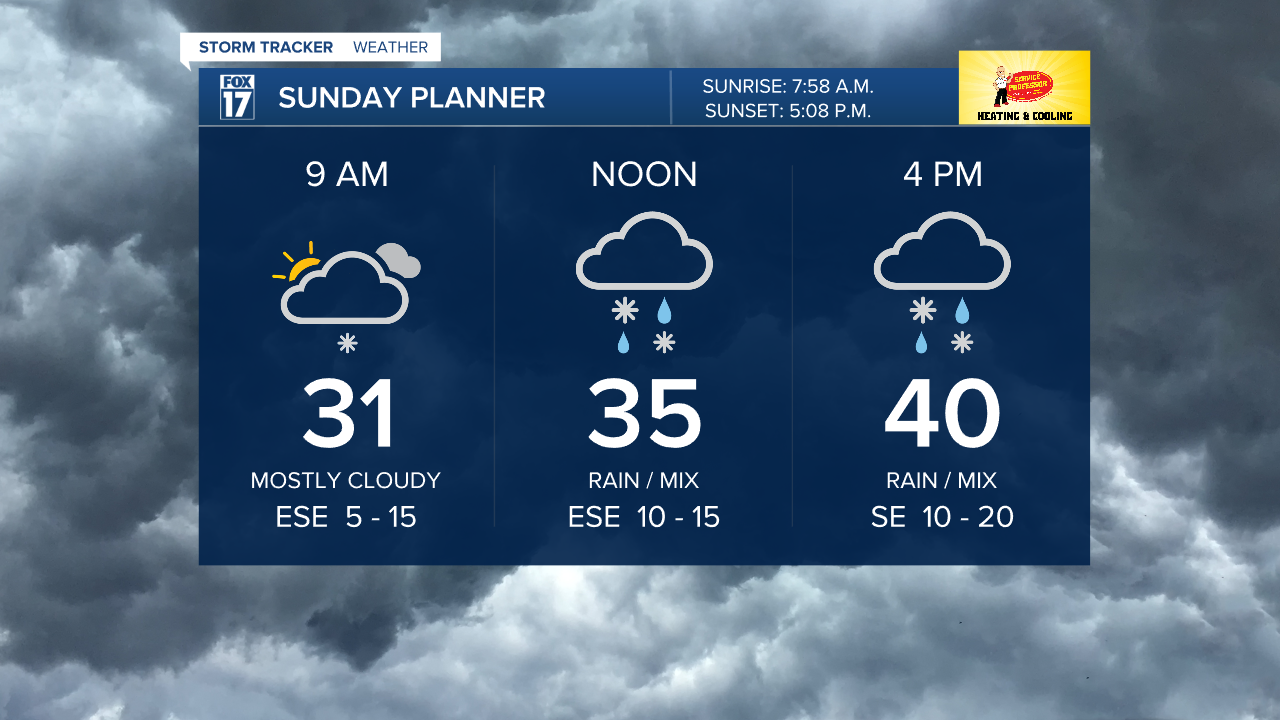
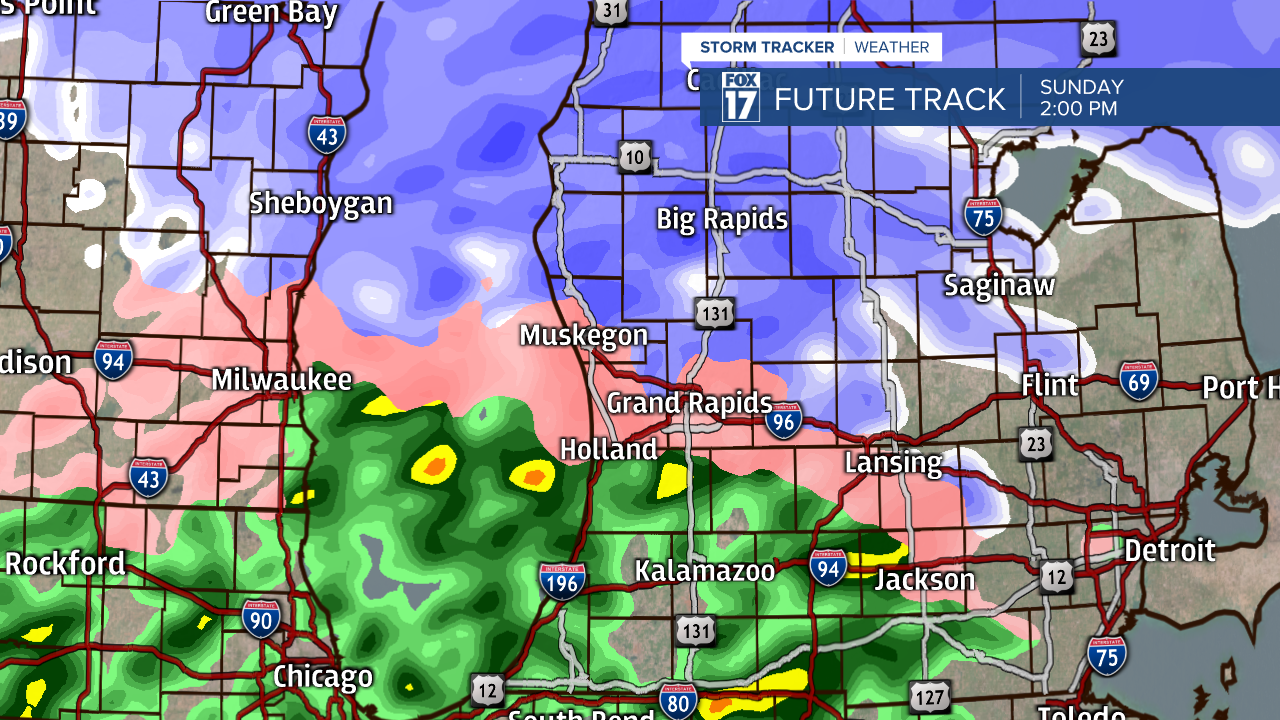
We will have more rain as you travel south and more snow north with the wintry mix and freezing rain chances in the middle. We have the chance to have the freezing rain develop a tenth of an inch of ice with lighter rain southward and about 1 to 3 inches of snowfall north.
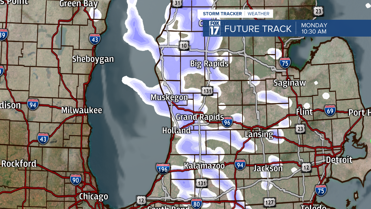
We will get a break in activity overnight Sunday into Monday as colder air starts to wrap around this system pushing us to have lake effect snow showers on Monday. Lake effect snow can push inland and stay with us through the afternoon and early evening.
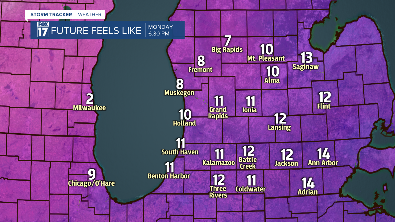
The winds will continue to be high and even stronger on Monday with gusts upwards of 45 mph. These winds will make us feel like we are in the teens and single digits.
Overall Sunday we can see a possible 1-3 inches of snowfall north of I-96 and then a general 1 to 3 inches of snowfall possible on Monday with our lake effect snow showers. Our most north communities will have the best chance to see the most snow.
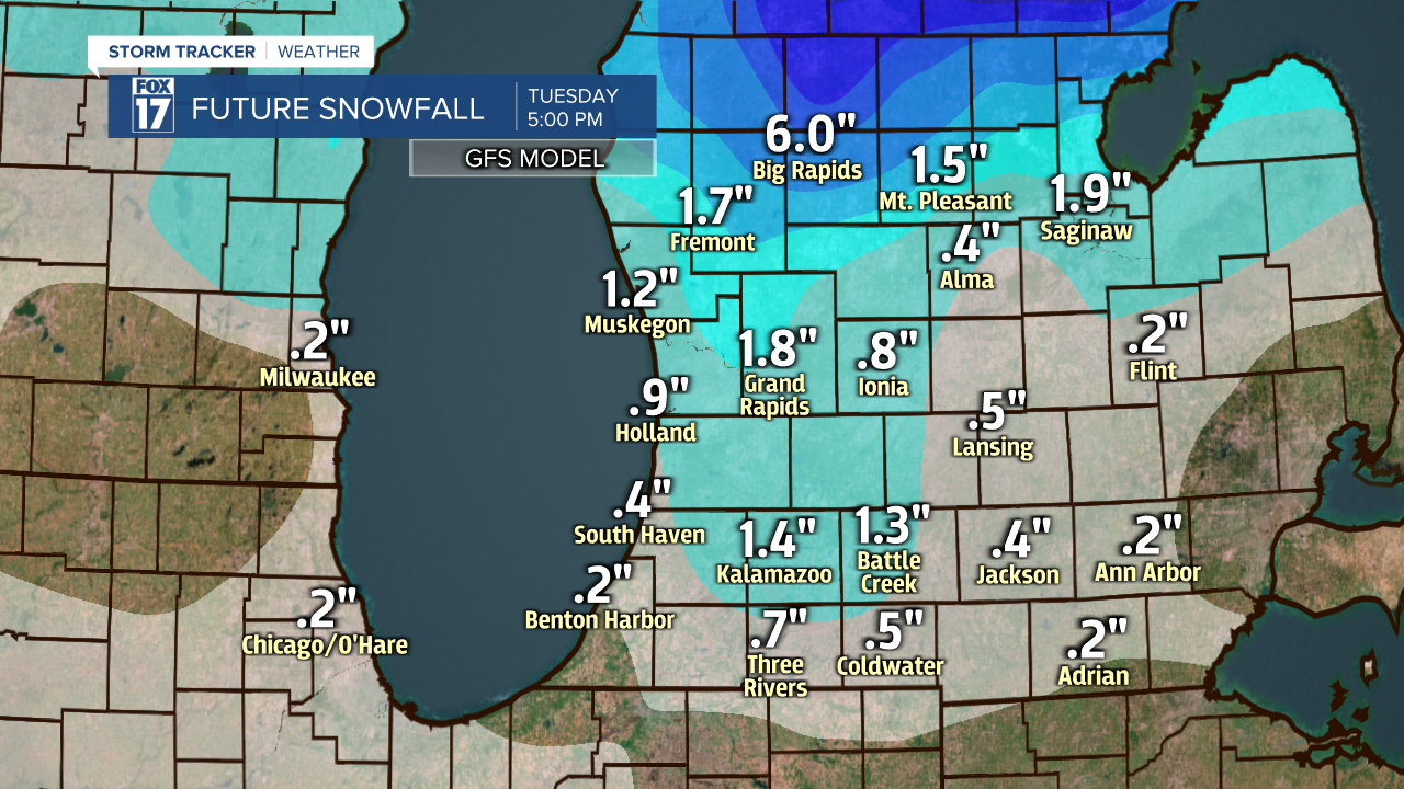
We will have another weak system pushing through late Tuesday into Wednesday with minor snow chances. Wintry mix chances also remain Thursday and Saturday. Check back throughout the week for updates with all our snow and wintry mix chances. Temperatures do push to the upper 30s by next weekend.

