


GRAND RAPIDS — West Michigan will see light snow throughout the first half of Sunday as accumulations can build to a half an inch to 1-2 inches of snowfall with the highest totals north of I-96. This snow is fighting against dry air and will be very light throughout the day likely leading to lower snowfall totals. Temperatures stay seasonable pushing into the lower 30s, but feel a bit cooler with a southeast breeze.

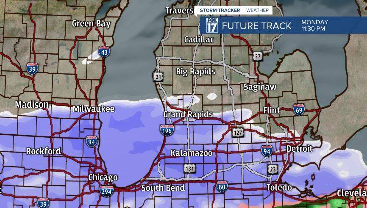
We will get a break from any snow activity Sunday night and into the first half of Monday. Our next system will take its time to arrive not working into West Michigan until late afternoon or early evening on Monday. This will be more wide spread synoptic snow that will focus most of the snowfall along and south of I-96. This snow can be heavy at times and lead to difficult travel out on the roadways especially for Tuesday's morning commute. We expect to see 3-6 inches of snowfall with some locations possibly gaining more snow. The highest snowfall totals will be found around I-94 area and light totals as you travel north.


We will have another chance of some snow mostly on Wednesday and bring back sunshine chances Thursday and Friday as our temperatures increase a bit. A chance of rain/snow mix arrives next weekend as well. Stay safe and check back for any updates on our snow this week happening Monday night into Tuesday.

