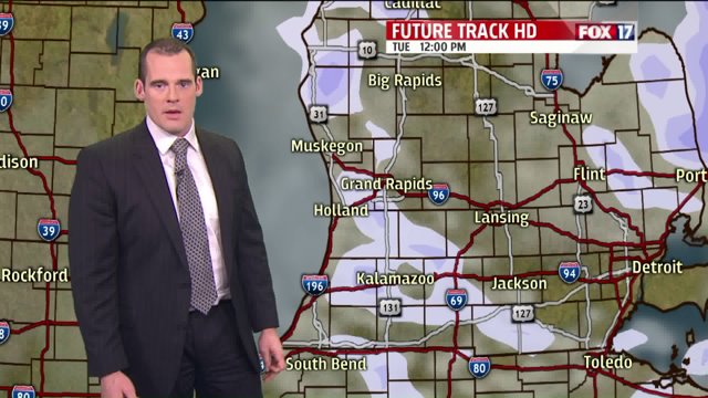
Light, fluffy lake effect snow will continue overnight and into much of the day on Monday with another inch of accumulation possible; perhaps 2″ in a few isolated spots. Then our attention will turn to an “Alberta Clipper” area of low pressure that will drop into West Michigan Monday night into Tuesday morning.
The low pressure system itself will likely bring at least a couple inches of accumulating snow during that time frame, then we will have to watch for more lake effect snow behind it on Tuesday afternoon. This is how much snow the global model is suggesting will fall between now and Tuesday night:

Now some may wonder if this will actually happen, considering our weekend “snow storm” dropped a lot less snow than expected. As a previous article stated, the snow on Saturday night/Sunday morning wasn’t as significant due to the warm air hanging on a couple hours longer than was forecasted. With temperatures staying well below freezing through Tuesday and beyond, forecasting precipitation type shouldn’t be an issue this time around.
So at this time, we are confident that the snow will be enough to make travel difficult on Tuesday morning. (Of course, we will keep you updated as we approach Monday night.) In the meantime, plan for snow and some blowing snow Monday night into Tuesday along with below average temperatures.


