


WEST MICHIGAN — FOX 17 has issued a Weather Ready Alert for Friday night into Saturday morning due to the risk of strong winds and quarter-sized hail.
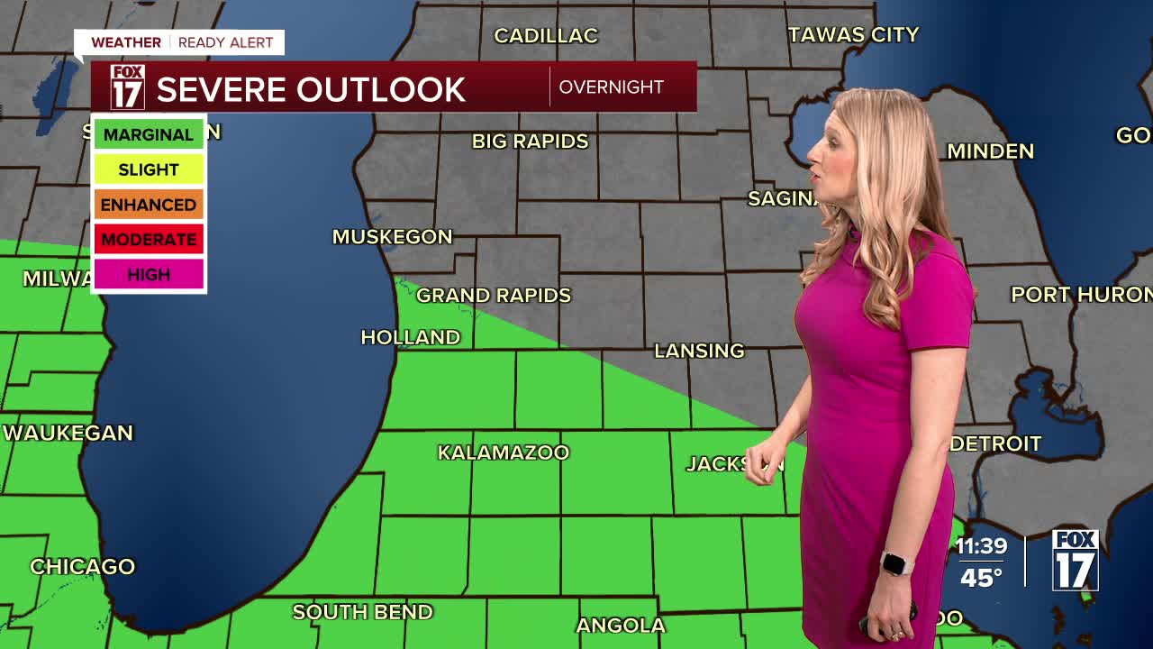
A warm front will lift in from the south, reaching West Michigan around midnight. Parts of West Michigan from Holland south to the Indiana state line are included in a MARGINAL RISK (Level 1 out of 5) for isolated strong to severe storms.

The storm risk will end around 9 a.m. Saturday but rain and non-severe thunderstorms will continue through midday.
Storms will drift north around midnight, with mainly a heavy rain risk.

Storms will increase in coverage overnight into early Saturday morning. Make sure you have ways to get weather warnings overnight in the event a severe thunderstorm warning is issued.

You may get woken up by some thunder booms!

A few storms with 40-50 mph gusts are possible during this time as well.

Storms will start to move away into the mid-morning, and West Michigan is not currently included in the severe weather risk area for Saturday. However, additional rain showers will continue through the early afternoon and could contribute to flooding in low-lying and prone areas.

Rain totals will be 1-2" with isolated higher amounts. In addition to street ponding, river levels will rise as well. Some of the regular spots along the Grand River and Muskegon River could rise into minor flood stage due to the added rain with this system.

Want alerts when inconvenient or severe weather is headed your way? Download the FOX 17 Weather app and set up notifications for where you live.
For the latest details on the weather in West Michigan, head to the FOX 17 Weather page.
Follow FOX 17: Facebook - X (formerly Twitter) - Instagram - YouTube
