
WEST MICHIGAN- We’ve avoided them for longer than normal, but it was bound to happen eventually. I’m talking about the arrival of freezing temperatures. Fortunately we’re still at the point in the season that we can only expect that freezing mark overnight.

Our average first freeze throughout West Michigan was actually a little over a week ago, if not longer in some of our northern areas. We’ve already cooled down over the last few days, but a sharper cool down is expected this weekend.
![]()
Cold Canadian air will move down just in time for this weekend. The bulk of this cold air will linger centrally over our area Saturday into Sunday morning, thus providing us with frost and freeze potential.
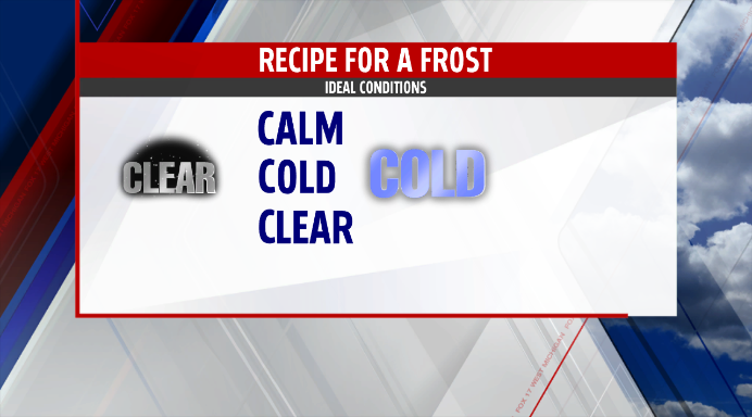
Saturday morning will be the first cold day of the weekend. Patchy frost occurred in some areas last Saturday, but it looks as if this Saturday morning, you’ll encounter something that will require you to break out the ice scraper. It’s already going to be cold, but it looks as if we may clear out Saturday morning as well. That combined with calm winds will allow moisture to settle and freeze on grassy and metallic surfaces.
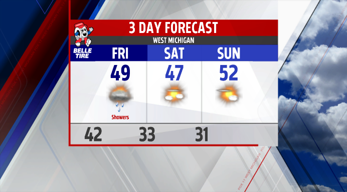
Even colder air is expected for Sunday morning, with temperatures at or below the freezing mark of 32 degrees. If you’re not quite ready for this on a consistent basis, not to worry. The beginning of next week allows for a warming trend that will get us back into the 60s for highs and 40s for lows overnight.
To send your pictures of the frost and those car thermometers this weekend: FOX 17 Facebook
For the latest forecast and current conditions: FOX 17 Weather
