

WEST MICHIGAN (March 20, 2014) — While Spring may have arrived on Thursday at 12:57 P.M., it wasn’t very spring-like. High temperatures across most of the area were mainly stuck in the mid/upper 30s. That’s about 10 degrees below normal!
Meteorologists at the National Weather Service Climate Prediction Center that specialize in longer range forecasts just came out with their spring outlook. Unfortunately, it calls for a 30 to 40 percent chance of below normal temperatures from the Northern Plains of the Dakotas, to the Upper Midwest, and through the Great Lakes. The outlook is valid for the months of April, May, and June. The best chance of above normal temperatures is across California and parts of the Southwest.
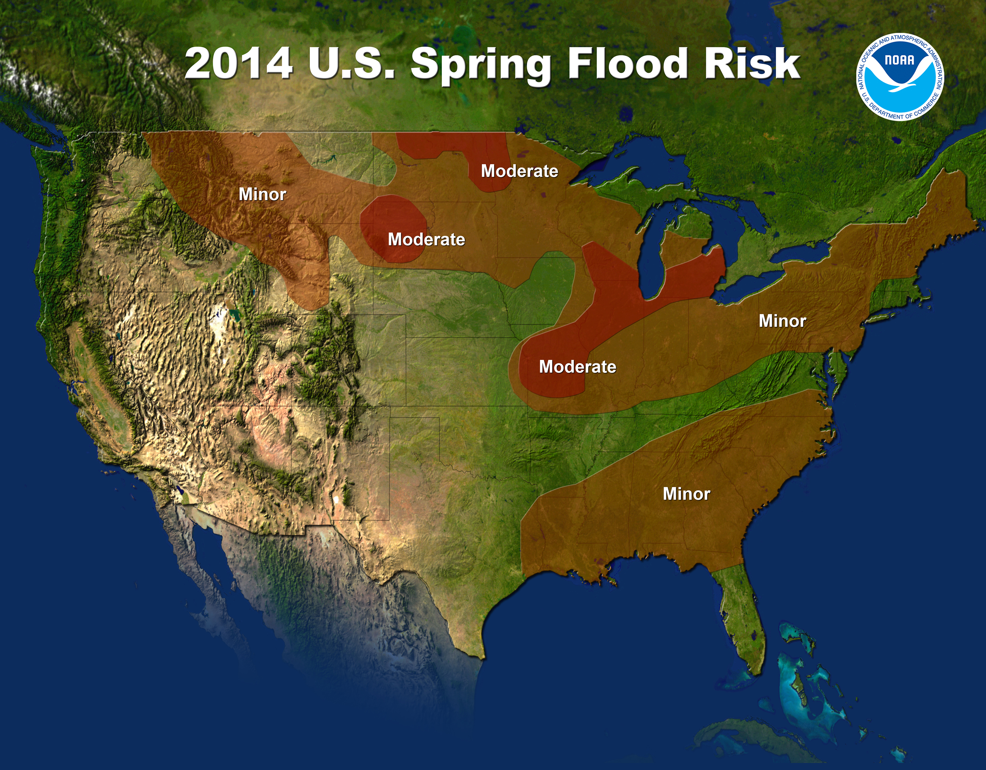
If that wasn’t bad enough, NWS Meteorologists and Hydrologists are expected moderate spring flooding across southern lower Michigan from snow melt and potential spring rains. See map below.
After a brief warm up on Friday with some P.M. rain showers, we’ll see temperatures dip below normal as we head through the remainder of the seven-day forecast.Click here to see the details.