
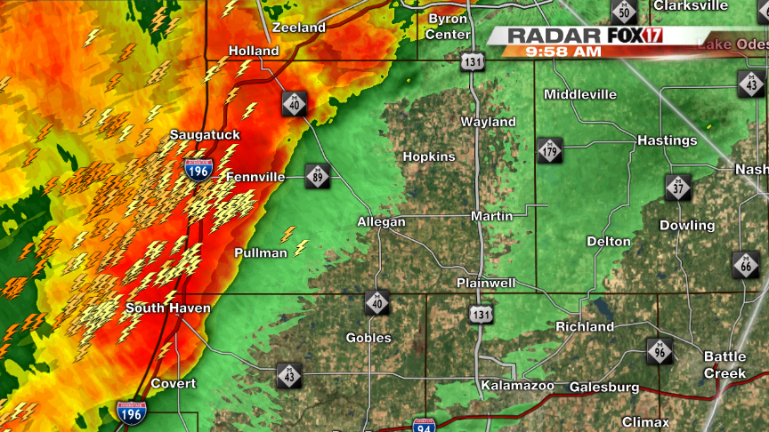
(WEST MICHIGAN) — Heavy rain, lightning and gusty winds are possible this morning and afternoon as storms move across a stalled frontal boundary. Storms will move to the east-northeast this afternoon and most should stay below severe criteria. Some stronger storms could be possible south towards the Indiana border where there is a little more instability.
Heavy rains over the last 24 hours are causing issues with flooding especially in areas like Muskegon where the snow melt have rivers and creeks out of their banks. Here is a list of some totals around West Michigan from the last 24 hours:
Allegan County:
Fennville – 0.80″
Barry County:
Hastings – 0.30″
Calhoun County:
Battle Creek Airport – 0.21″
Ionia County:
Belding – 1.67″
Clarksville – 1.30″
Kalamazoo County:
Kalamazoo – 0.18″
Vicksburg – 0.11″
Kent County:
Rockford – 2.67″
Sparta – 2.19″
Caledonia – 1.91
Gerald R Ford Airport – 1.28″
Kent City – 1.25″
East Grand Rapids – 1.21″
Mecosta County:
Big Rapids – 1.65″
Muskegon County:
Muskegon – 1.44″
Oceana County:
Hart – 1.68″
Ottawa County:
Hudsonville – 2.18″
Nunica – 1.43″
Allendale – 1.41″
Holland – 1.31″
Van Buren County:
Keeler – 0.07″
As of 11am Wednesday morning another quarter to half of an inch has fallen.
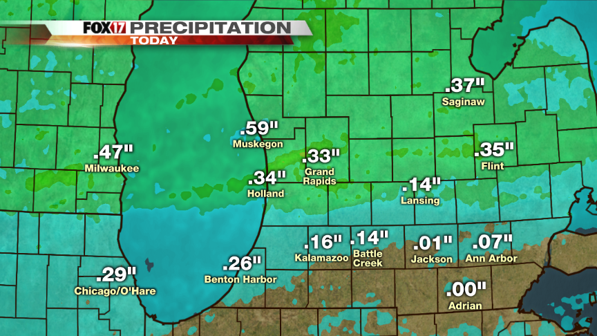
Showers will continue through the overnight tonight and into Thursday afternoon. Another 1 to 2 inches will be possible north of I-94 adding more water to an already soaked West Michigan.

Temperatures will then fall tonight into the mid to upper 30’s. It is possible to see some areas of light freezing rain or freezing drizzle before sunrise north of the Grand Rapids area. When the sun rises temperatures should warm just enough to allow for light rain but better chances for more winter-like weather return on Friday morning where a messy wintry mix will be possible in the early morning hours. No accumulations are expected Friday, but some areas north of I-96 could see a light dusting. Typically, today April 10th is the average last day of snow, and with the exception of Friday it looks like it will be the last day of snow chances in the next 7 days.
