
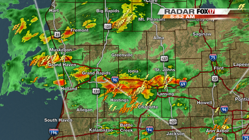
(WEST MICHIGAN) — Heavy rain, thunder and lightning are waking many of us up this morning as thunderstorms are moving towards the east-northeast. Storms will bring areas of heavy rain with around one to two inches possible through Thursday. Saturated soil and full riverbanks will be inundated with more water today causing problems with flooding, many areas are being monitored for flood conditions.
Temperatures will fall through the overnight tonight allowing for some chances of freezing rain especially in the northern counties. Best potential for freezing rain will be north of Grand Rapids around sunrise. Temperatures will stay cooler than average however should stay above freezing in Grand Rapids and south. We will continue to monitor the chance for freezing rain and bring you updates on Fox 17 News.
