


After wrapping up February this weekend on a "spring-like" note, winter will return Monday and force us to break out the heavier jackets.
A cold front will move through Sunday evening, bringing cooler air into the area for Monday. Overnight temperatures won't be pleasant but will still be a little bit above normal in the middle 20s. What will really bring the chill Monday is a secondary cold front working through the area during the afternoon. This will push temperatures even lower, increase the wind and even produce some snow. Highs temperatures Monday in the lower and middle 30s will happen just before this cold front in the late morning to early afternoon.
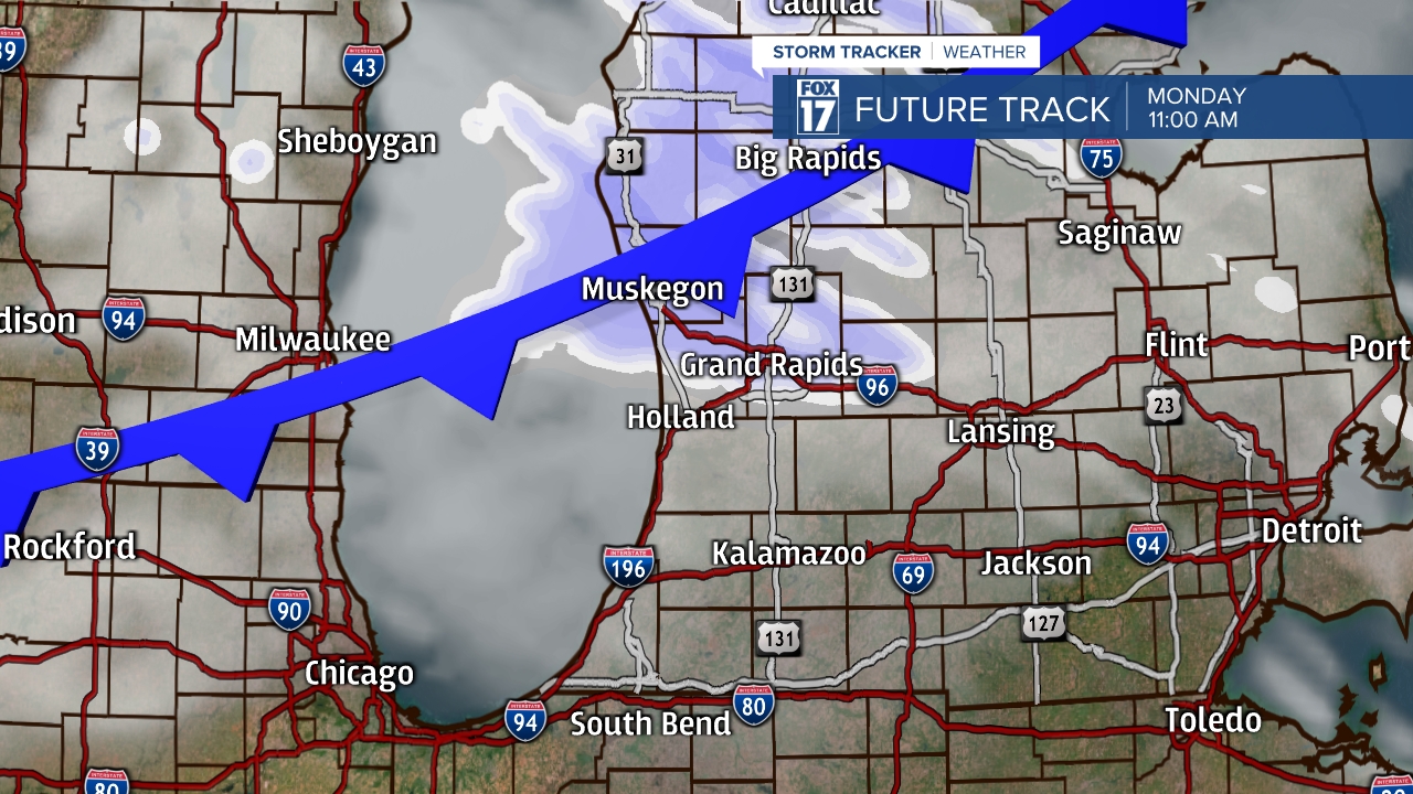
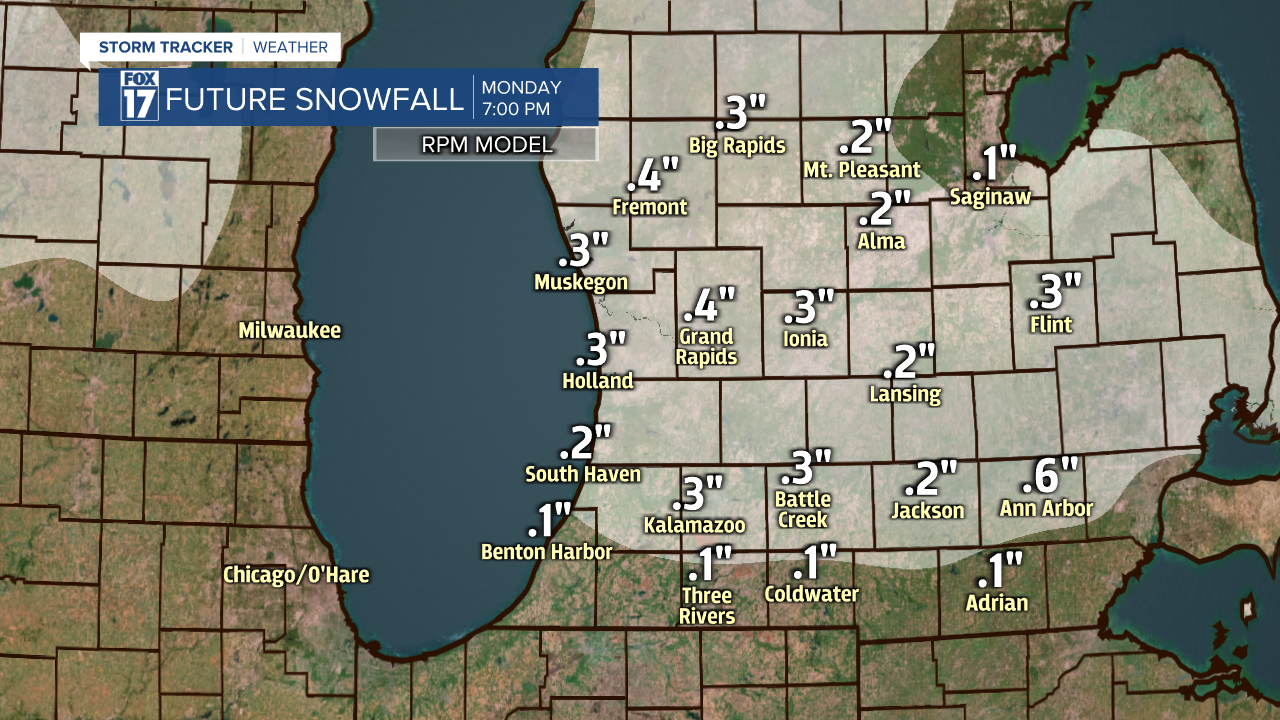
With the cold front Monday afternoon, snow showers will develop and could be heavy at times for an hour or two. Due to the short nature of the snow, it will likely not accumulate to more than a dusting, but could cause some slower travel in the afternoon.
The biggest issue with this front will be the stronger winds in combination with the colder temperatures. With sustained winds of 10-20 mph, gusts between 25-35 mph and temperatures dropping from the 30s into the 20s, wind chills will get well down into the teens. It will not be a fun start to March.

Even though we will dip back into winter tomorrow, it will only be Monday that we have to deal with the cold, snow and wind. High pressure will quickly swing in from the west Tuesday, leading to the return of some sunshine. The winds will also decrease and temperatures will climb back into the lower 40s. This sunnier and warmer trend will continue for the rest of the week after Tuesday!

