


WEST MICHIGAN — For 6 months in a row, and 8 of 9 this year, most of West Michigan measured below average precipitation.
Grand Rapids, Holland, and Muskegon have seen at least 2/3's of their respective months be drier than normal. Here's the breakdown.
| City | September Surplus/Deficit | Yearly Surplus/Deficit | Months Drier than Normal - 2025 |
| Grand Rapids | -0.98" | -8.42" | 8 of 9 |
| Holland | +1.13" | -6.91" | 7 of 9 |
| Muskegon | -2.41" | -6.10" | 6 of 9 |
| Kalamazoo | -1.40" | +0.17" | 5 of 9 |
| Battle Creek | -0.24" | +6.87" | 4 of 9 |
A big concern in the chart's spread is yearly numbers. Grand Rapids and Battle Creek have a 10" rainfall difference on the year, and more than 15" inches between the surplus & deficit!
This has created large discrepancies in crop harvest quality, and water levels on rivers & streams.

The Grand River in Grand Rapids is the lowest since at least 2000. Fall colors are delayed with the drought & heat, and will likely limit vibrancy.
Is there any hope for some steady moisture from the clouds in October? In short, not really.
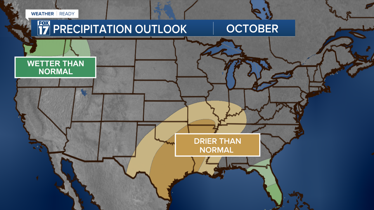
The first week is forecast confidently to be dry & very warm. The long term outlook shows warmth continues all month, while precipitation remains seasonable.
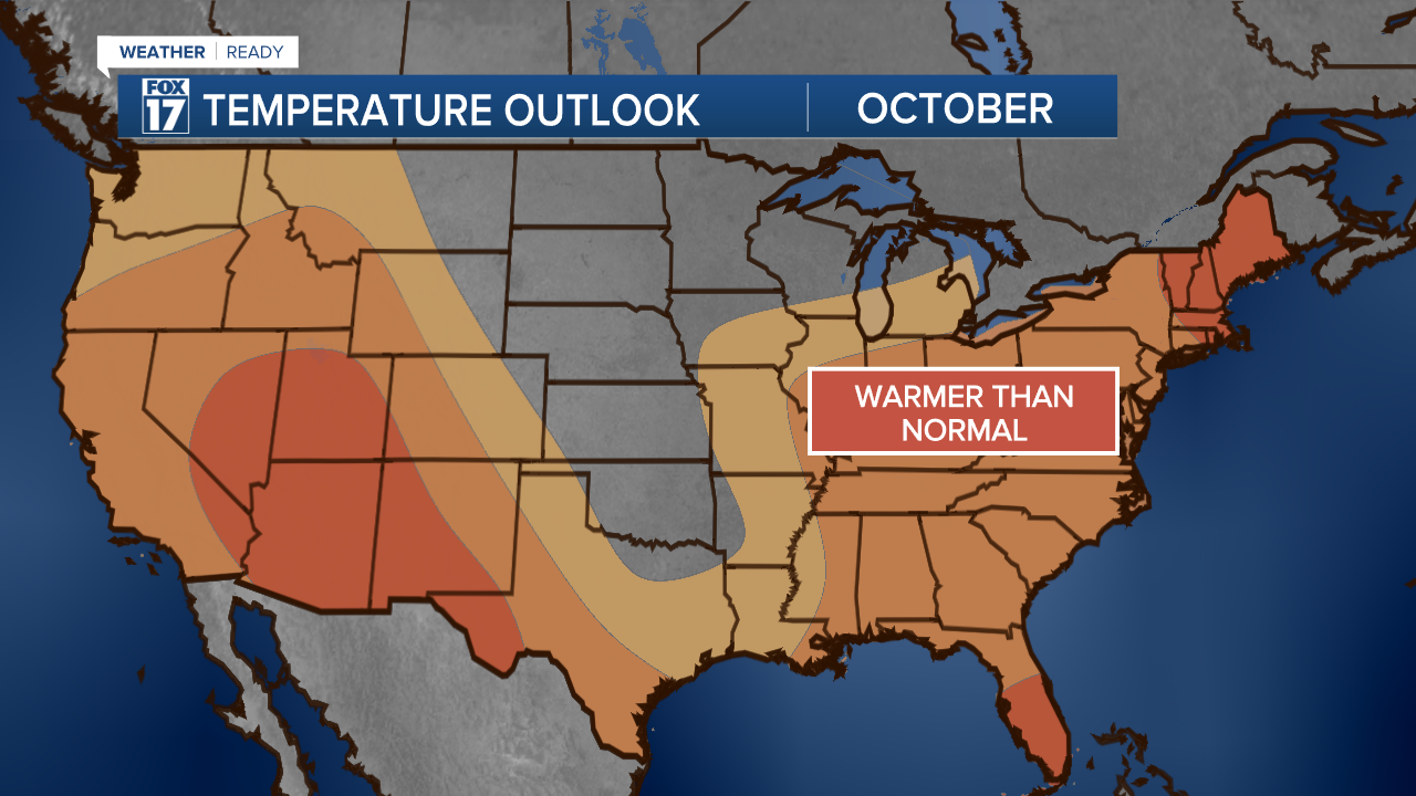
This means unless we get a massive pattern change, we will see warmth win over a cool rain into Fall.
For the latest details on the weather in West Michigan, head to the FOX 17 Weather page.
Follow FOX 17: Facebook - X (formerly Twitter) - Instagram - YouTube
