


WEST MICHIGAN — A WINTER STORM WARNING continues through 12 AM Tuesday for much of West Michigan, mainly lakeshore counties; also included in the warning are Kalamazoo and Newaygo Counties. Most inland areas are in a WINTER WEATHER ADVISORY. While snow continues to taper down, the strong winds associated with this low pressure system will keep blowing snow and reduced visibility an issue.

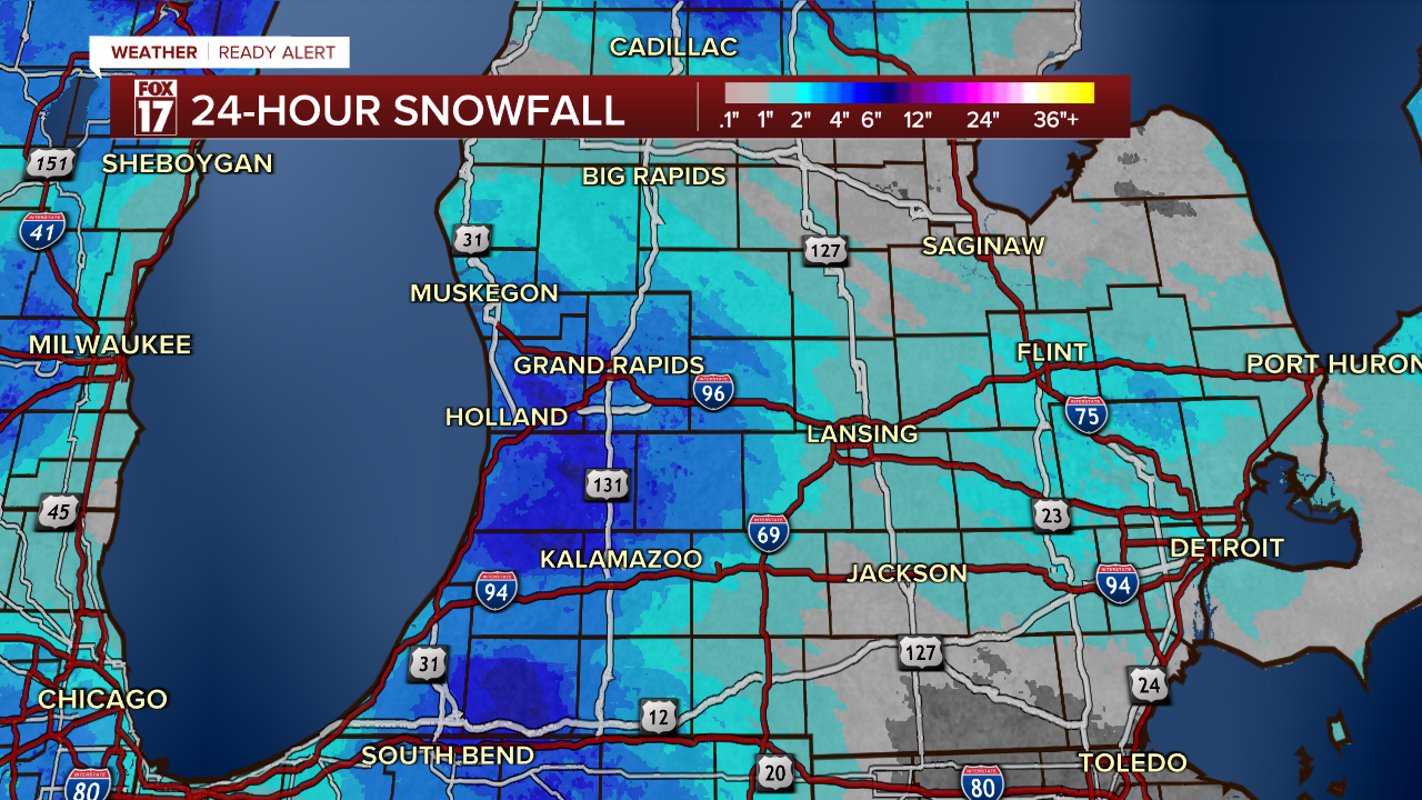
Snow totals through Monday afternoon have eclipsed 3-6" in many spots, with another 1" possible overnight especially along the lakeshore.
A few persistent lake effect snow showers will linger through the late evening and overnight. Blowing snow and low visibility will be more of an issue as winds remain high with 25-30 mph gusts.

Many stay dry through early Tuesday morning but another round of snow is on the way Tuesday afternoon and evening.
Additional snow totals will be highest near the lakeshore, but breezy winds carrying the snow bands further inland will also lead to a few isolated higher totals near the 131 corridor.

Expect some dangerous travel conditions at times, primarily from blowing snow and on secondary roads that aren't plowed as consistently as the main roads.
For the latest details on the weather in West Michigan, head to the FOX 17 Weather page.
Follow FOX 17: Facebook - X (formerly Twitter) - Instagram - YouTube
