


WEST MICHIGAN — For the first time in two weeks, the desperate West Michigan area is finally getting rainfall! There was even a report of a waterspout offshore near South Haven earlier Monday evening.
The FOX 17 Weather Ready Team is issuing a WEATHER READY ALERT for the whole region through midday today (Tuesday) for steady to moderate rainfall, isolated thunderstorms and potential impacts to your morning commute.
While widespread severe weather is unlikely, occasionally storms could become strong or marginally severe with 30 to 40 mph wind gusts.
The most widespread rain will be this morning. While the thunderstorm threat is low, we expect heavier bands of rain south and east of Grand Rapids.

Most rain amounts will be between a quarter and third of an inch, But within those heavier bands, totals for some could be topping 1"! West Michigan hasn't seen measurable rain since September 23rd (13 days ago).
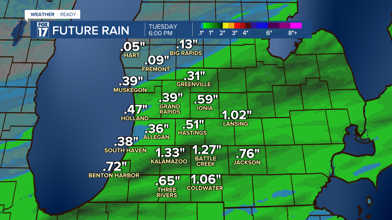
Light showers could linger as late as early afternoon for areas east of Kalamazoo, but most will be done with the rain by mid-morning.
For the latest details on the weather in West Michigan, head to the FOX 17 Weather page.
Follow FOX 17: Facebook - X (formerly Twitter) - Instagram - YouTube
