


WEST MICHIGAN — A WEATHER READY ALERT has been issued for West Michigan, for today (Wednesday, January 21). Fox17 meteorologists are tracking another low pressure system bringing widespread accumulating snow overnight and Wednesday morning, which will create difficult travel conditions.
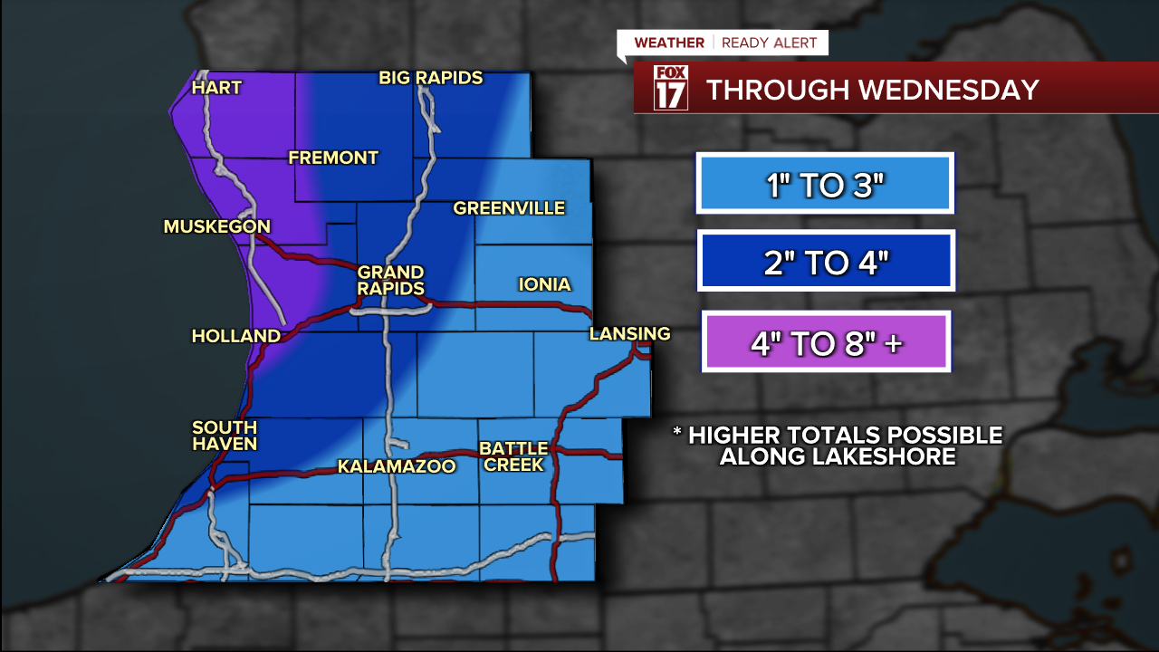
Winter alerts have been issued for all of West Michigan to account for this next system. Most are in a WINTER WEATHER ADVISORY (purple), but Oceana, Muskegon and Ottawa counties are in a WINTER STORM WARNING (pink) for higher amounts of snow.
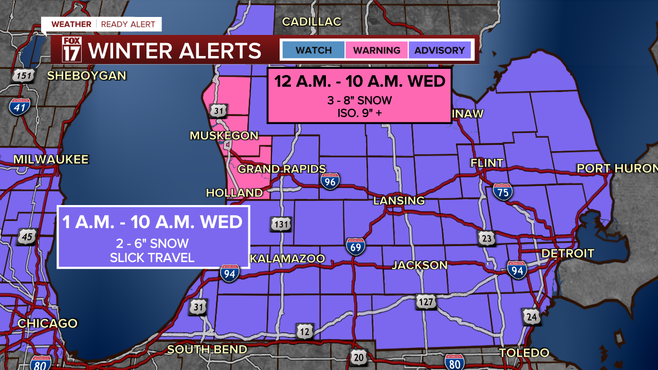
Snow totals will be 3-6" for most, but isolated areas of 5-8" of snow are expected in the advisory area, with pockets of 8-12" of snow in the winter storm warning closer to the lakeshore.
Timing of the snow will be through midday, meaning the morning commute will be especially challenging given the packed snow from earlier this week, snow from overnight, and ongoing moderate to heavy snow. Road conditions will become marginally better this afternoon and evening as heavy snow tapers down, but ongoing slick spots, reduced visibility and pockets of lake effect snow are expected to continue.

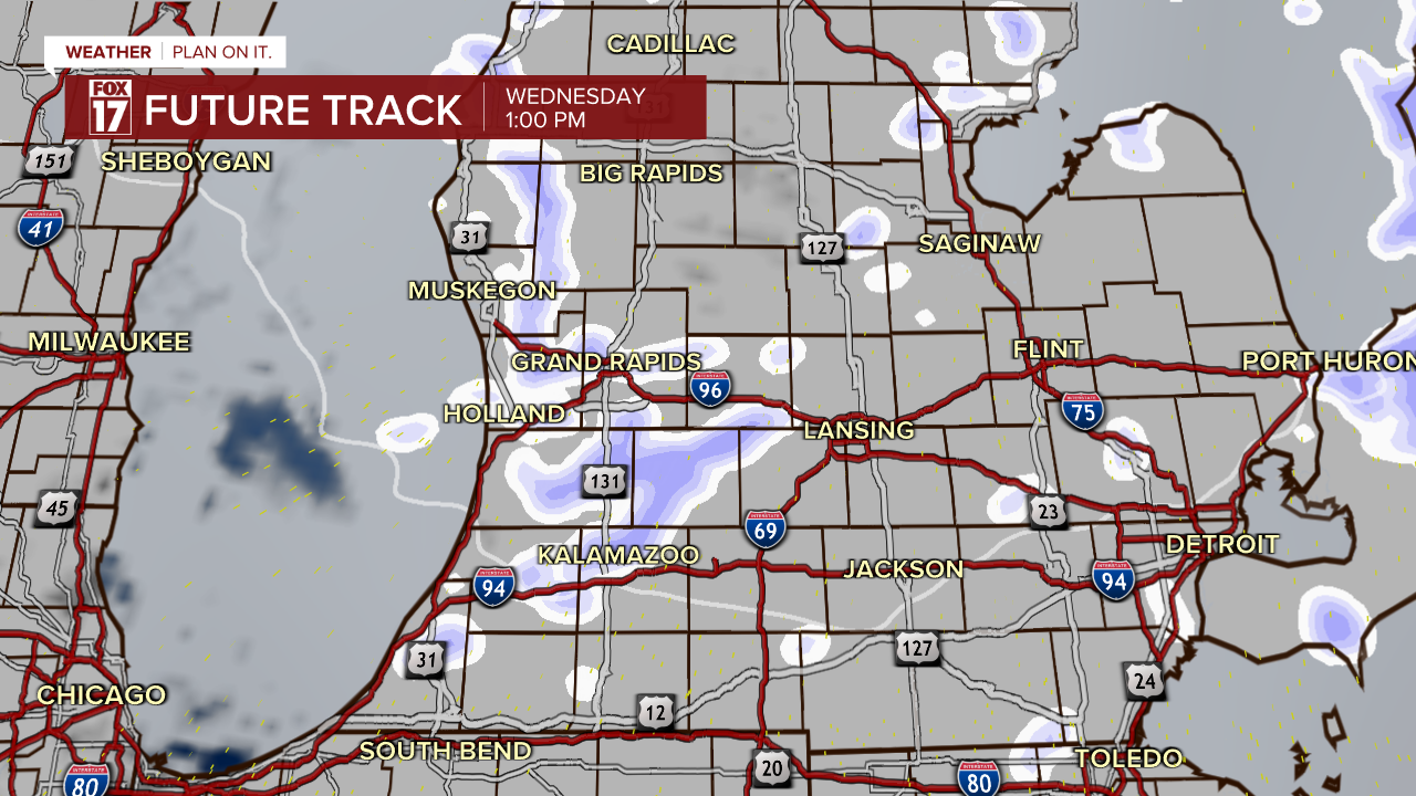
A low pressure system moves from the Plains into northern Illinois later this evening, getting close enough to West Michigan by around midnight for the snow to start falling. It will be light at first, but become heavier and more widespread overnight.
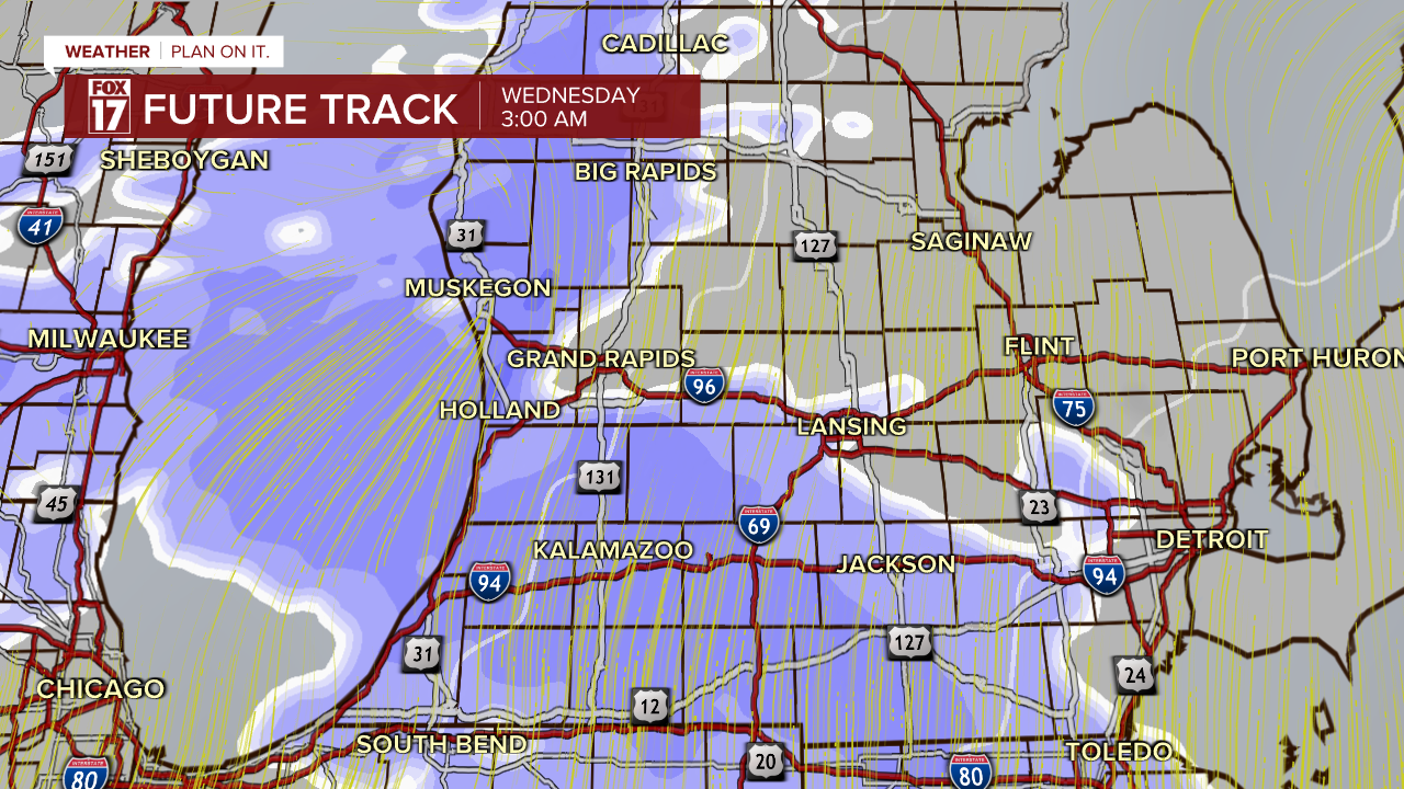
By 7 a.m., heavy snow is still ongoing throughout most of West Michigan. Road conditions will be very poor during this time, so allow extra time to get to work or school.
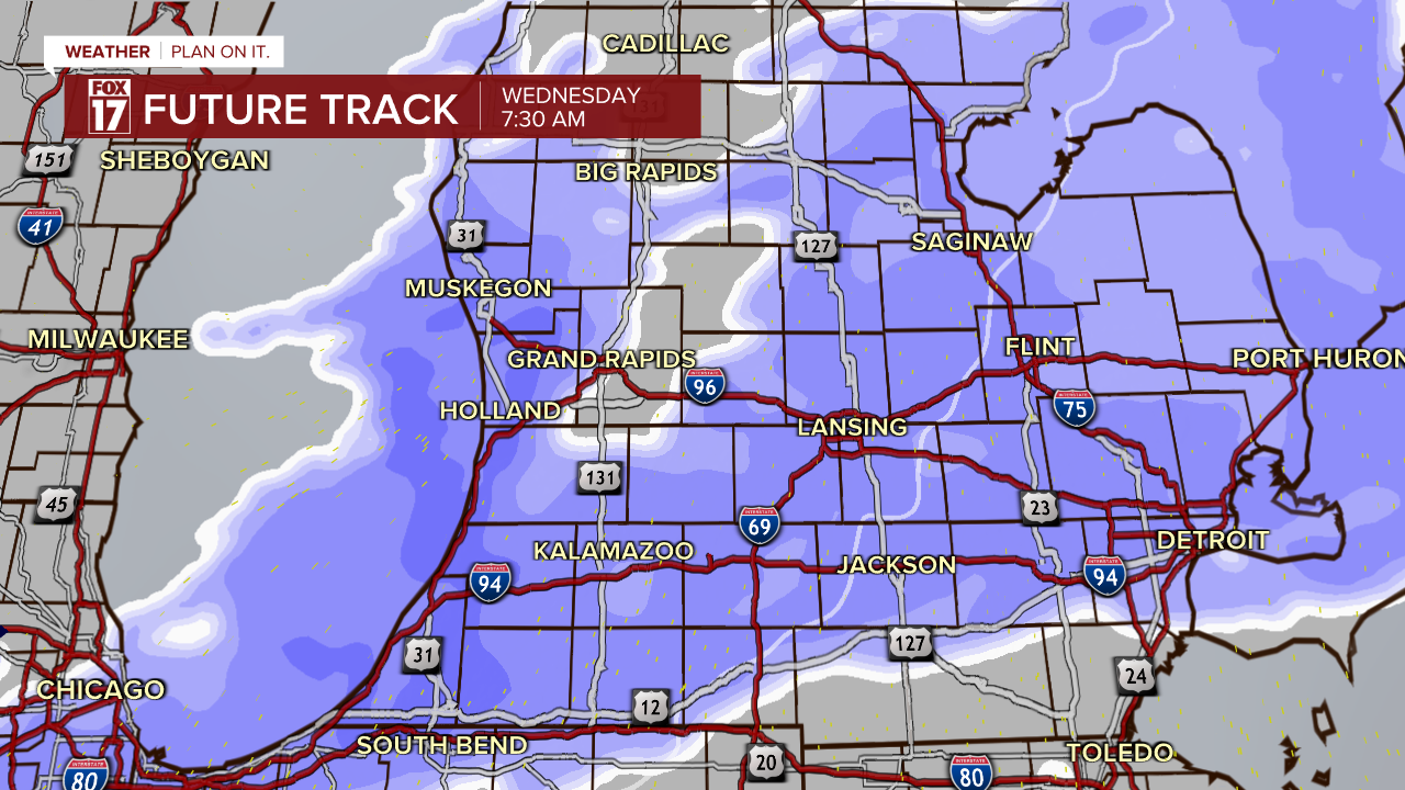
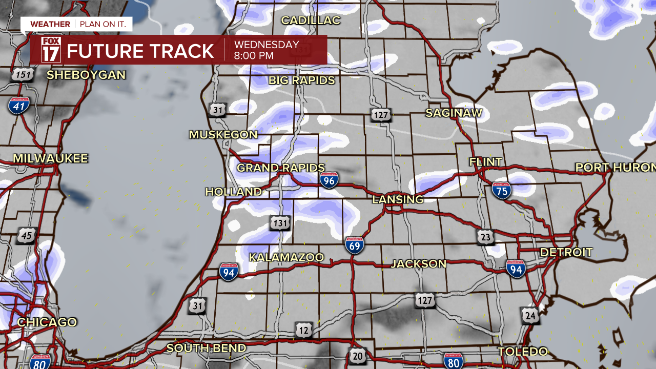
As the cold front passes by during the mid-morning, heavy snow will taper down and lake effect snow will fire up.
Although the winter alerts end at 10 a.m. Wednesday, pockets of heavy lake effect snow will be possible during the day, adding to the snow totals from overnight and early Wednesday morning.
By Thursday evening, the lake effect is tapering down.
Snow totals will be highest near the lakeshore, with 6-8" expected and isolated higher totals possible. Most of West Michigan will end up with 2-4" and isolated 4-6".
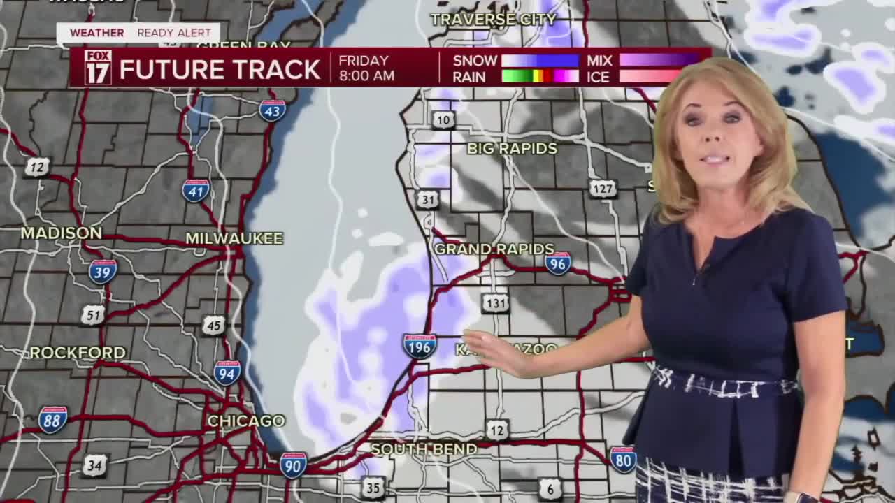
Another more widespread round of snow is expected to impact areas south of I-96 into early Thursday, so another rough commute is possible for some.
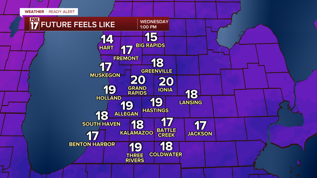
Wind chills will not be as terrible as they were Monday and Tuesday, since the warm front generating the snow will draw some slightly "warmer" air in. But it will still be feeling like near 10 Wednesday morning.
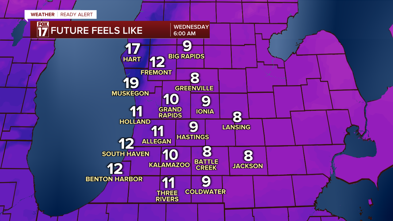
Afternoon wind chills will be in the upper teens and low 20s, which is the warmest it will be over the next 5 or 6 days.
For the latest details on the weather in West Michigan, head to the FOX 17 Weather page.
Follow FOX 17: Facebook - X (formerly Twitter) - Instagram - YouTube
