


The WEATHER READY ALERT continues throughout the weekend for near record cold and dangerously cold wind chills, along with travel issues from blowing snow and slick roads.
The frigid air will continue to grip West Michigan through the weekend, with true Polar air sinking into the Great Lakes this morning. Wind chills will remain below zero today, but the winds won't be as strong as Friday, so wind chills will generally hold in the zero to -10 range. The extreme cold warning and advisory have been allowed to expire. This morning was incredibly cold, with actual air temperatures this morning dropping to the -15 to -30 range, which is dangerously cold.
Here's a look at the temperatures from 6AM:

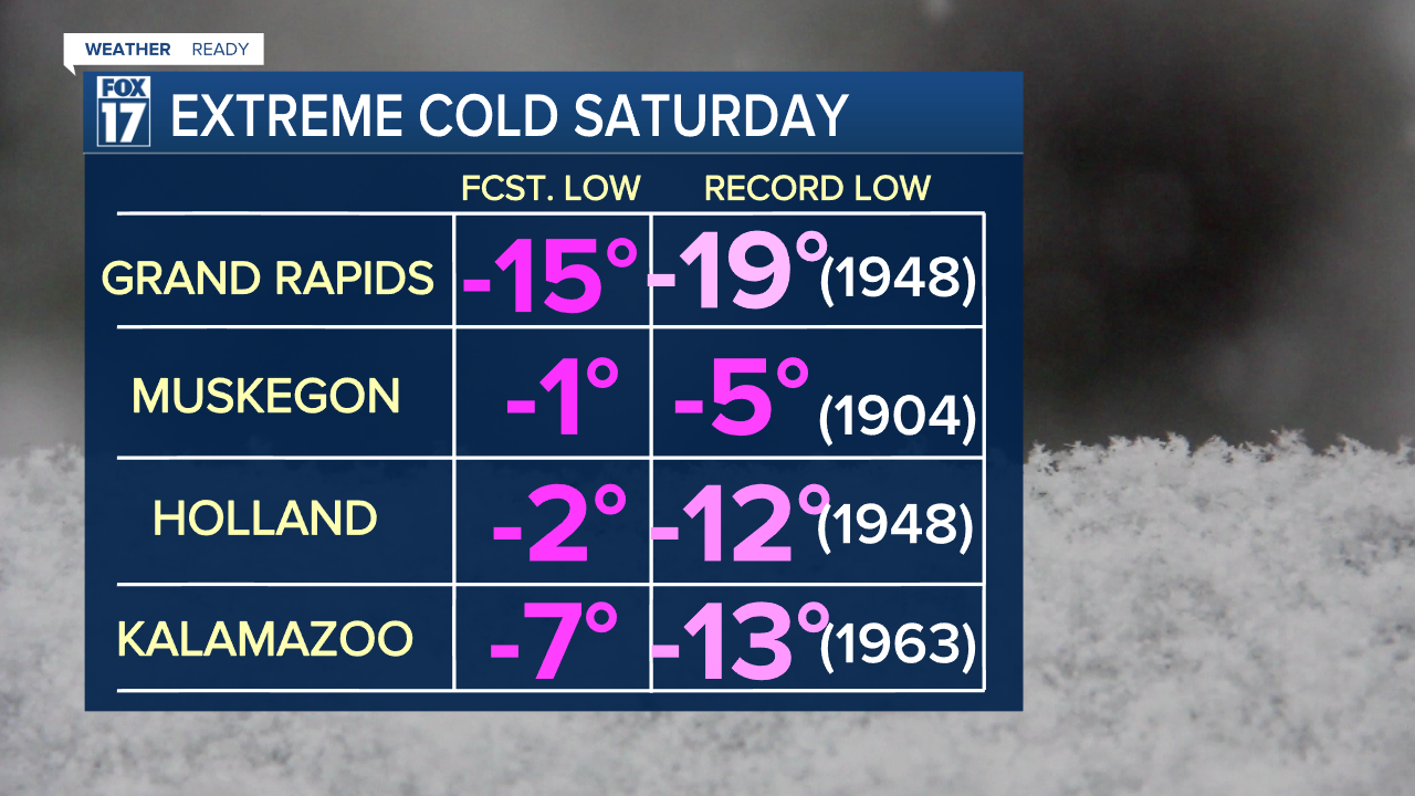
Here's a look at the current records:
After morning temperatures well below zero, this afternoon's temperatures will only be in the single digits below zero, as winds won't be as strong this afternoon. Pets and outdoor animals need a safe, warm place during this time as well.
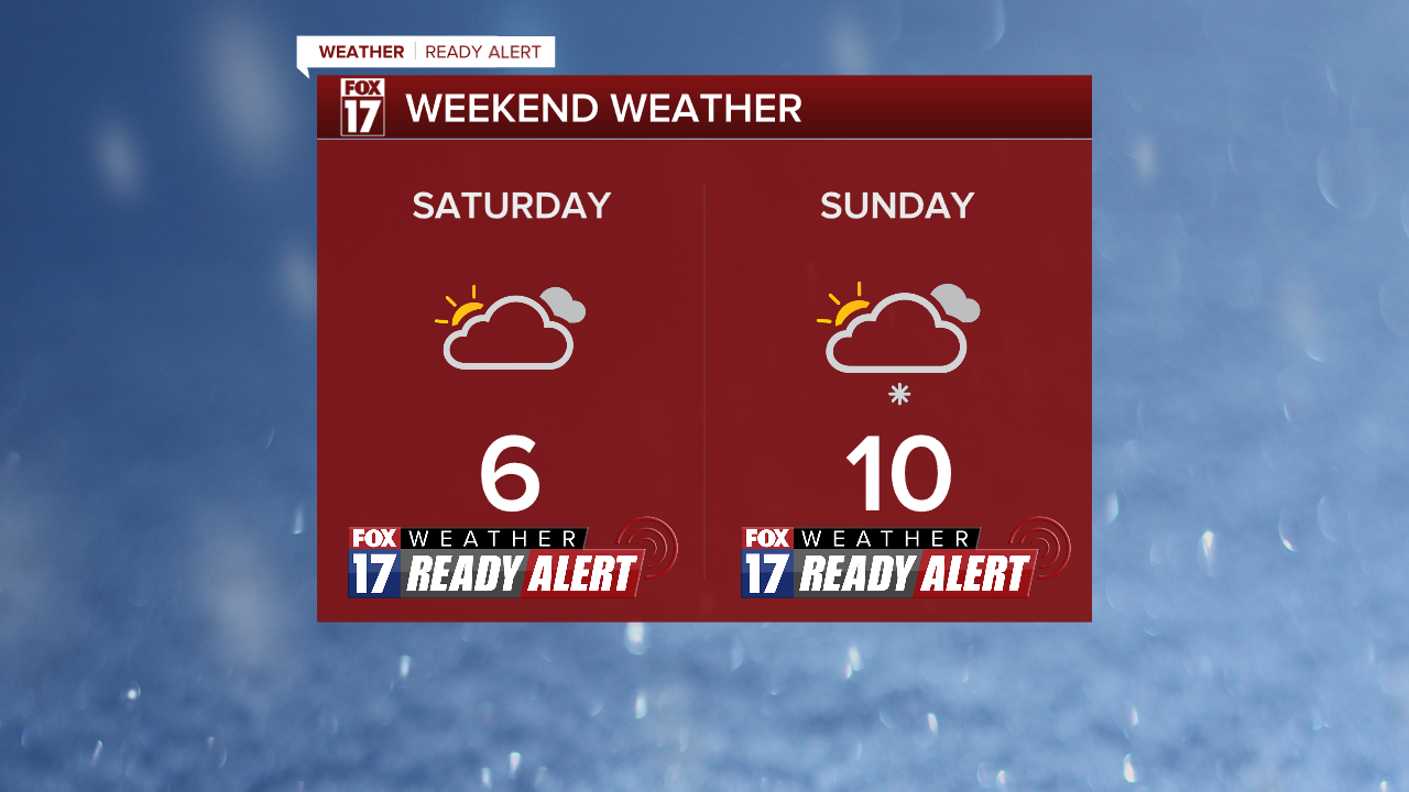
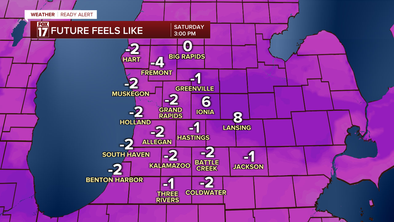
Highs Saturday afternoon top out in the 4 to 8 range, with wind chills around -5. 6 is the record cold high for Grand Rapids, and we have a chance of tying that record. Muskegon, Holland and Kalamazoo will also come within a few degrees of breaking or tying the record cold high temperatures Saturday afternoon.
It continues to "warm up" slightly Sunday onward, but will still be extremely cold with highs in the teens and lows close to but slightly above 0.
For the latest details on the weather in West Michigan, head to the FOX 17 Weather page.
Follow FOX 17: Facebook - X (formerly Twitter) - Instagram - YouTube
