


WEST MICHIGAN — Fox17 meteorologists have issued a WEATHER READY ALERT through Tuesday, January 20 due to dangerously cold wind chills for much of the day, along with challenging travel conditions. Winds gradually relax. Snow showers diminish afternoon. More widespread snow arrives tonight.

By mid-morning, most of the snow will be fading away and many will have a mainly dry afternoon.

There will still be difficult road conditions with some challenging travel. Be prepared for quickly changing visibility and snow-covered roads.
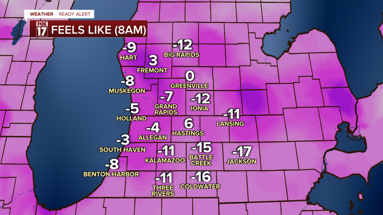
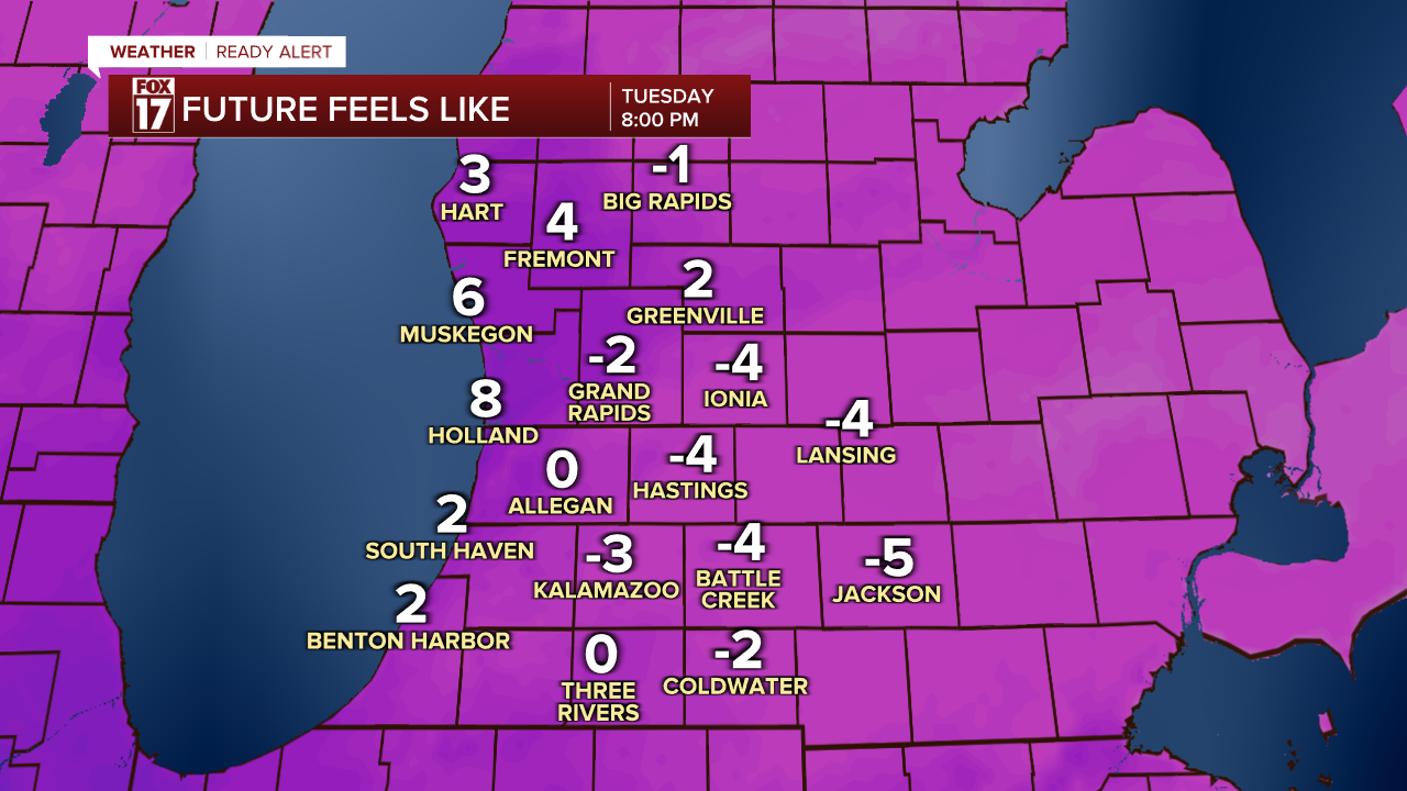
It will be slightly warmer in the afternoon with wind chills around 0.
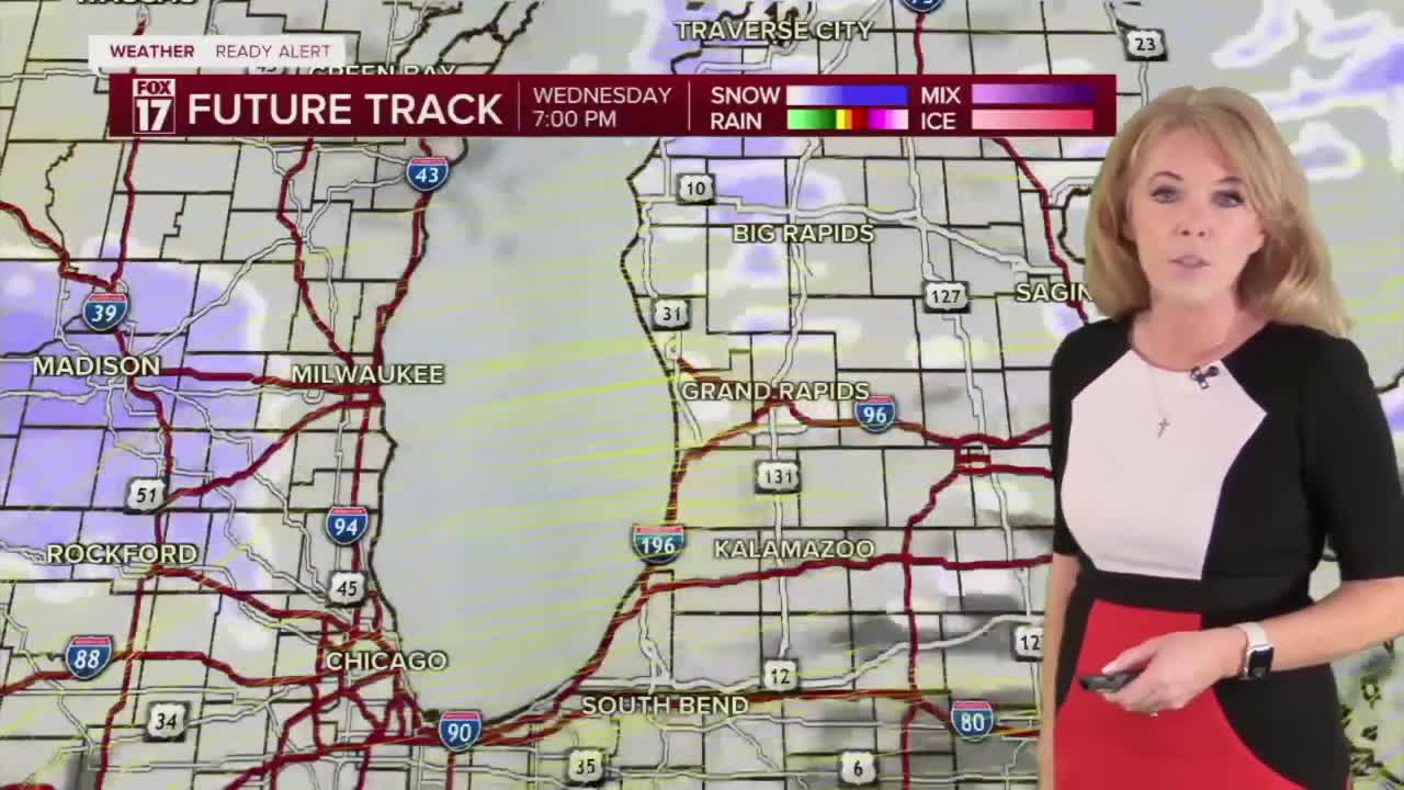
More widespread snow arrives Tuesday night into Wednesday.
The image below is the projection for 5am Wednesday

The image below is the projection for 8am Wednesday

The image below is the projection for 2PM Wednesday

The image below is the projection for 11:30PM Wednesday

Another round of even colder Arctic air will be moving in this weekend with potentially record-setting cold.
For the latest details on the weather in West Michigan, head to the FOX 17 Weather page.
Follow FOX 17: Facebook - X (formerly Twitter) - Instagram - YouTube
